| The Families In British India Society (FIBIS) is a self-help organisation devoted to members researching their British India family history and the background against which their ancestors led their lives in India under British rule. Let FIBIS help you break down those brick walls in your research |
Rangoon: Difference between revisions
Jump to navigation
Jump to search
intro line |
No edit summary |
||
| Line 21: | Line 21: | ||
Modern name: Yangon<br> | Modern name: Yangon<br> | ||
Variants: Rangoon<br> | Variants: Rangoon<br> | ||
==Maps== | |||
*[http://www.lib.utexas.edu/maps/historical/rangoon_1912.jpg Map of Rangoon 1912] from the Historical Maps of Asia Collection, University of Texas, Austin | |||
[[Category:Locations]] | [[Category:Locations]] | ||
[[Category:Burma]] | [[Category:Burma]] | ||
[[Category:Cities, towns and villages in Madras Presidency]] | [[Category:Cities, towns and villages in Madras Presidency]] | ||
Revision as of 11:31, 26 February 2010
| Rangoon | |
|---|---|
| [[Image:|250px| ]] | |
| Presidency: Madras Presidency | |
| Coordinates: | 16.868878°N 96.236255°E |
| Altitude: | |
| Present Day Details | |
| Place Name: | Yangon |
| State/Province: | Yangon Division |
| Country: | Burma |
| Transport links | |
Rangoon, in what was formerly known as Lower Burma, was the capital of British Burma from 1885.
History
Rangoon came under British rule in the 1850s and was transformed into a busy commercial port. It became the capital of British Burma after Upper Burma was captured in the 3rd Burma War, making overland access from the rest of British India possible.
- Occupation of Rangoon 1824, part of the 1st Burma War
- Battle of Rangoon 1852, part of the 2nd Burma War
Spelling Variants
Modern name: Yangon
Variants: Rangoon
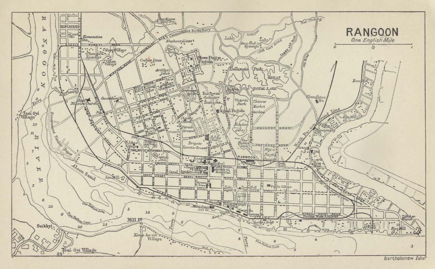
Maps
- Map of Rangoon 1912 from the Historical Maps of Asia Collection, University of Texas, Austin