Bangalore
| Bangalore | |
|---|---|

| |
| Presidency: Madras | |
| Coordinates: | 12.966667°N, 77.566667°E |
| Altitude: | 920 m (3,018 ft) |
| Present Day Details | |
| Place Name: | Bengaluru |
| State/Province: | Karnataka |
| Country: | India |
| Transport links | |
| Chikballapur-Bangalore City Railway Madras Railway Mysore State Railway Southern Mahratta Railway | |
| FibiWiki Maps | |
|---|---|
| See our interactive map of this location showing places of interest during the British period | |
| Bangalore |
Bangalore (now Bengaluru) became part of British India in 1809. It was the scene of a mutiny in 1832, which was unsuccessful. Bangalore is the capital of the modern Indian state of Karnataka.
Although situated in Mysore State, which was a Princely State not part of British India, the Civil and Military Station at Bangalore was an Assigned Tract under British administration.
It was the location of a major cantonment which was in existence in 1829, and perhaps established earlier. The main barracks was Baird Barracks, in Cubbon Road.
Hebbal Camp and Gaza Camp were in existence during the First World War period and Hebbal Camp continued at least until the late 1920s.
The Royal Air Force during the Second World War had a base in Bangalore which included Jalahalli and RAF Yelahanka.
During the Second World War there were Prisoner of War Camps for Italian prisoners at Jakkur, Hebbal and Jalahalli.[1]
Contents
Also see
- POW Camps in India
- Bangalore Battalion, a Volunteer Regiment, earlier known as the Bangalore Rifle Volunteers.
Military history
Military
Battle of Bangalore 1791
Bangalore Mutiny 1832
Gallery
See also Images of Bangalore
Cemeteries
- Bangalore Cemeteries
- Agram Cemetery, Gravestone Inscriptions 1806-1866 (Old Protestant Cemetery)
FIBIS resources
Churches
- St John's Church, 132 St John's Church Road
- St Patrick's Cathedral, Brigade Road
- Album of Parish Priest Rev Fr Maria Antoine Tabard Prepared at time of Cathedral refurbishment in 1899. gallery.fibis.org
- Fibiwiki images of St Patrick's Cathedral
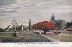
- St Mark's Cathedral Church, MG Road
- St Andrew's Church
Schools and Colleges
- St Joseph's Boys' High School
- Baldwins Boys High School, Hosur Road
- St. Joseph's College, Lalbagh Road
Palaces
- Bangalore Royal Palace, Jayamahal Road
- Tipu Sultan's Summer Palace, wikipedia.com. The palace, built mostly from wood, dates from 1791.
External links
- Catholic Archdiocese of Bangalore
- Bangalore Wikipedia
- Bangalore map 1924 Wikipedia
- The late Ronnie Johnson's archived Bangalore site - covers many topics including cemeteries, churches, streets and houses, schools and more
- Regiments in Bangalore 1807 to 1913 - an archived link
- [Bangalore] Cantonment: colonial past, multicultural present by Poornima Dasharathi , 23 Jul 2008 bangalore.citizenmatters.in
- "Marching to a different beat. Armed forces are a large presence in Bangalore" by Deepti Ganapathy Times of India
- Image: Christmas Menu “No 3 and Furlough Coys, IWT , RE” Gaza Camp, Bangalore India, Christmas 1918. auctiva.com. Retrieved 16 August 2014. IWT is presumably Inland Water Transport, part of the Royal Engineers, but it is not otherwise known to have been in India.
- The O.T.S Bangalore by John Forster bbc.co.uk/ww2peopleswar. The Officers'Training School during WW2
- RAF Yelahanka rafweb.org
- Yelahanka Wikipedia
- Whitefield, Bangalore established 1882 livemint.com Friday, 14 October 2011
- Personal collection of over 100 photos of Bangalore, mainly taken between 1909-1925www.sharehistory.org
- Back to Bangalore Part 1 Video Photographic documentary about two press photographers, Anglo Indian Bert Scott and grandson Jason Tilley. They travel to India in 1999 in search of their colonial past. Back to Bangalore Part 2, includes a visit to Seringapatum cemetery. Filmed by Vicki Couchman. This further video Photographer in Residence: Jason Tilley also discusses the 1999 trip to India. Vimeo.com and from thebeautifulpeopleblog, category "My Family History" which contains a number of interesting blogs
Historical books online
- Bangalore Imperial Gazetteer of India Volume 6, page 368.
- "Map of Bangalore", between pages 388 and 389, A Handbook for Travellers in India, Burma, and Ceylon published by John Murray, London Eighth Edition 1911 Archive.org.
- "Bangalore", page 45 Report on the Medical Topography and Statistics, of the Mysore Division of the Madras Army 1844 Google Books (This report is at the rear of Report on the Medical Topography and Statistics, of the Provinces of Malabar and Canara)
- Bangalore page 67, The Edinburgh Medical and Surgical Journal Volume 68 1847. The cantonment was classified as one of the "Stations on the Table Lands" Google Books
- "Bangalore" page 411 Report of the Commissioners Appointed to Inquire into the Sanitary State of the Army in India : with Abstract of Evidence, and of Reports Received from Indian Military Stations 1864 Archive.org
- Sanitary Report Bangalore 1864. Cover title is Report on the Station, Barracks and Hospitals of Bangalore. Extracted from the Proceedings of the Sanitary Commission. 1865. Archive.org
- Bangalore Cantonment page 48 Mysore and Coorg, A Gazetteer compiled by the Government of India Volume II, Mysore by Districts by Lewis Rice 1876 Archive.org
- The Civil and Military station of Bangalore, within direct British jurisdiction c 1883 page 57 Memoirs, with a Full Account of the Great Malaria Problem and its Solution by Ronald Ross 1923 Archive.org.
- Old Bungalows in Bangalore, South India by Janet Pott 1977 Archive.org
- Monkey Tops: Old Buildings in Bangalore Cantonment by Elizabeth Staley 1981 Archive.org
References
- ↑ Pensioner’s Paradise or POW Camp ? by Aliyeh Rizvi, July 7, 2011


