Belgaum
Jump to navigation
Jump to search
| Belgaum | |
|---|---|
| [[Image:|250px| ]] | |
| Presidency: Bombay | |
| Coordinates: | 15.850362°N 74.504672°E |
| Altitude: | 762 m (2,500 ft) |
| Present Day Details | |
| Place Name: | Belgaum |
| State/Province: | Karnataka |
| Country: | India |
| Transport links | |
| Southern Mahratta Railway | |
| FibiWiki Maps | |
|---|---|
| See our interactive map of this location showing places of interest during the British period | |
| Belgaum |
Contents
THIS PAGE IS WAITING FOR MORE DETAILED INFORMATION
Belgaum came under the control of the British in 1818 at the end of the 3rd Maratha War when the Maratha empire was broken up. It was the headquarters of Belgaum District in the Southern division of Bombay Presidency during the British period.
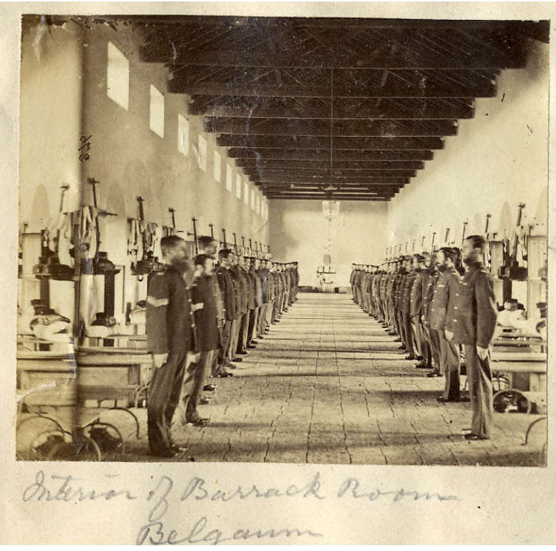
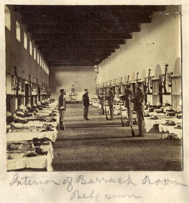
A cantonment was located there.
Spelling variants
Modern name: Belgaum
Variants: Belgaon
Military history
Siege of Belgaum 1818

Churches
St Mary's Church, Belgaum Bombay Diocesan Trust
Internment Camp
There was an internment camp in Belgaum for German and Austrian civilians during the First World War. For more details see POW Camps in India
External links
- Belgaum Town Imperial Gazetteer
- Photograph: Interior of Barrack Room, Belgaum 1860 and another view of the Interior of Barrack Room, Belgaum from this page of Prof Fran Pritchett’s Indian Routes website
- Postcard: The Cantonment Garden, Belgaum The Army Children Archive (TACA). A slightly larger version advising that the bandstand is shown. www.stamps-auction.com
- The Diary of Frederick Pendall, a member of the Norfolk regiment who was in Belgaum from March 1917 to March 1918
Historical books on-line
- Belgaum Gazetteer of the Bombay Presidency Vol XXI 1884