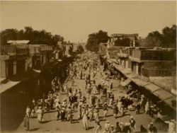
Difference between revisions of "Peshawar"
Jump to navigation
Jump to search
Symorsebrown (talk | contribs) (Add external link.) |
(Peshawar lies in KP not FATA) |
||
| Line 5: | Line 5: | ||
|altitude= 510 m (1,673 ft) | |altitude= 510 m (1,673 ft) | ||
|presentname= [http://en.wikipedia.org/wiki/Peshawar Peshawar] | |presentname= [http://en.wikipedia.org/wiki/Peshawar Peshawar] | ||
| − | |stateprovince=[http://en.wikipedia.org/wiki/ | + | |stateprovince=[http://en.wikipedia.org/wiki/Khyber_Pakhtunkhwa Khyber Pakhtoonkhwa] |
|country= [[Pakistan]] | |country= [[Pakistan]] | ||
}} | }} | ||
| − | '''Peshawar''' was capital of [[North West Frontier Province]] and [[Peshawar District]] from 1903 until 1947. | + | '''Peshawar''' was the capital of [[North West Frontier Province]] and [[Peshawar District]] from 1903 until 1947. |
==Education== | ==Education== | ||
Revision as of 23:43, 11 August 2010
| Peshawar | |
|---|---|

| |
| Presidency: Bengal | |
| Coordinates: | 34.015112°N 71.582634°E |
| Altitude: | 510 m (1,673 ft) |
| Present Day Details | |
| Place Name: | Peshawar |
| State/Province: | Khyber Pakhtoonkhwa |
| Country: | Pakistan |
| Transport links | |
Peshawar was the capital of North West Frontier Province and Peshawar District from 1903 until 1947.
Contents
Education
- Edwardes College
- Islamia College
Churches
- St. John's Church
