Shillong: Difference between revisions
Jump to navigation
Jump to search
m remove broken link |
No edit summary |
||
| Line 10: | Line 10: | ||
}} | }} | ||
{{Places of Interest|title=Shillong|name=Shillong|link=xxxxx}} | {{Places of Interest|title=Shillong|name=Shillong|link=xxxxx}} | ||
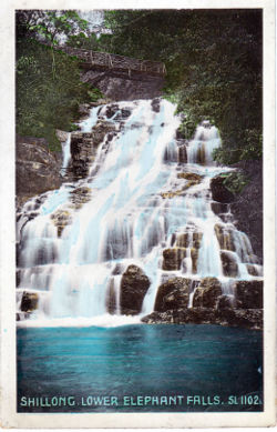
'''Shillong''' was the headquarters of [http://dsal.uchicago.edu/reference/gazetteer/pager.html?objectid=DS405.1.I34_V15_260.gif Khasi and Jaintia Hills District] in [[Assam|Assam Province]] during the British period. It had a Pasteur Institute and was wrecked by an earthquake in 1897.<ref name=Murrays>Murray's Handbook India, Burma and Ceylon 1933</ref> | '''Shillong''' was the headquarters of [http://dsal.uchicago.edu/reference/gazetteer/pager.html?objectid=DS405.1.I34_V15_260.gif Khasi and Jaintia Hills District] in [[Assam|Assam Province]] during the British period. It had a Pasteur Institute and was wrecked by an earthquake in 1897.<ref name=Murrays>Murray's Handbook India, Burma and Ceylon 1933</ref> | ||
| Line 21: | Line 20: | ||
==Also see== | ==Also see== | ||
*[[1897 Assam earthquake]] | *[[1897 Assam earthquake]] | ||
==External Links== | ==External Links== | ||
*[http://dsal.uchicago.edu/reference/gazetteer/pager.html?objectid=DS405.1.I34_V22_286.gif Shillong Town] Imperial Gazetteer of India | *[http://dsal.uchicago.edu/reference/gazetteer/pager.html?objectid=DS405.1.I34_V22_286.gif Shillong Town] Imperial Gazetteer of India | ||
*[http://cires.colorado.edu/~bilham/Shillong1897Photos/index.html Shillong before and after the 1897 Earthquake] including [http://cires.colorado.edu/~bilham/Shillong1897Photos/Pages/11.html Shillong Church before the 1897 earthquake] from Roger Bilham’s [http://cires.colorado.edu/~bilham Earthquakes and Tectonic Plate motions] | *[http://cires.colorado.edu/~bilham/Shillong1897Photos/index.html Shillong before and after the 1897 Earthquake] including [http://cires.colorado.edu/~bilham/Shillong1897Photos/Pages/11.html Shillong Church before the 1897 earthquake] from Roger Bilham’s [http://cires.colorado.edu/~bilham Earthquakes and Tectonic Plate motions] | ||
===Historical books online=== | |||
*[https://archive.org/details/assamdistrictga00allegoog ''Assam District Gazetteers: The Khasi and Jaintia Hills, the Garo Hills and the Lushai Hills Vol.10''] 1906 Archive.org. [http://eap.bl.uk/database/overview_item.a4d?catId=183535;r=8723 ''Volume10 Supplement''] 1915. British Library EAP file (Tiff images, may require a plug-in) | |||
== References == | |||
<references /> | |||
{{#widget:Google PlusOne | {{#widget:Google PlusOne | ||
Revision as of 06:53, 23 September 2015
| Shillong | |
|---|---|

| |
| Presidency: Bengal | |
| Coordinates: | 25.5667°N 91.8833°E |
| Altitude: | 1,525 m (5,003 ft) |
| Present Day Details | |
| Place Name: | Shillong |
| State/Province: | Meghalaya |
| Country: | India |
| Transport links | |
| FibiWiki Maps | |
|---|---|
| See our interactive map of this location showing places of interest during the British period | |
| [xxxxx Shillong] |
Shillong was the headquarters of Khasi and Jaintia Hills District in Assam Province during the British period. It had a Pasteur Institute and was wrecked by an earthquake in 1897.[1]
Churches
Also see
External Links
- Shillong Town Imperial Gazetteer of India
- Shillong before and after the 1897 Earthquake including Shillong Church before the 1897 earthquake from Roger Bilham’s Earthquakes and Tectonic Plate motions
Historical books online
- Assam District Gazetteers: The Khasi and Jaintia Hills, the Garo Hills and the Lushai Hills Vol.10 1906 Archive.org. Volume10 Supplement 1915. British Library EAP file (Tiff images, may require a plug-in)
References