Aligarh: Difference between revisions
Symorsebrown (talk | contribs) Spelling Variants |
No edit summary |
||
| (15 intermediate revisions by 5 users not shown) | |||
| Line 4: | Line 4: | ||
|coordinates=[http://maps.google.co.uk/maps?ll=27.896546,78.07366&z=14&t=h&hl=en 27.893754°N 78.068142°E] | |coordinates=[http://maps.google.co.uk/maps?ll=27.896546,78.07366&z=14&t=h&hl=en 27.893754°N 78.068142°E] | ||
|altitude=178 m (584 ft) | |altitude=178 m (584 ft) | ||
|presentname=[http:// | |presentname=[http://en.wikipedia.org/wiki/Aligarh,_Uttar_Pradesh Aligarh] | ||
|stateprovince=[http://en.wikipedia.org/wiki/Uttar_Pradesh Uttar Pradesh] | |stateprovince=[http://en.wikipedia.org/wiki/Uttar_Pradesh Uttar Pradesh] | ||
|country=[http:// | |country=[http://en.wikipedia.org/wiki/India India] | ||
|transport=[[East Indian Railway]]<br>[[Oudh and Rohilkhand Railway]] | |transport=[[East Indian Railway]]<br>[[Oudh and Rohilkhand Railway]] | ||
}} | }} | ||
{{Places of Interest|title=Aligarh|name=Aligarh |link=xxxxx}} | |||
'''Aligarh''', also known as Koil, was the | '''Aligarh''', also known as '''Koil''', was the headquarters of [http://dsal.uchicago.edu/reference/gazetteer/pager.html?objectid=DS405.1.I34_V05_215.gif Aligarh District] in the Meerut Division of United Provinces during the British period. It is situated about 75 miles south-east of [[Delhi]]. Aligarh's Civil Station lay north-east of the city. The old cantonment was abolished in 1869 and the old cemetery from 1802 is near the fort. | ||
==Military history == | |||
[[Battle of Alighur]] 1803<br> | |||
[[Battle of Allygurh August 1857]]<br> | |||
[[Battle of Allygurh October 1857]] | |||
== Spelling Variants == | |||
Modern name: Aligarh<br> | |||
Variants: Alighur/Aligurh/Allyghur/Allygurh/Alliegurh | |||
==Railways== | |||
Aligarh was a junction between the main line of the [[East Indian Railway]] and a branch of the [[Oudh and Rohilkhand Railway]]. | Aligarh was a junction between the main line of the [[East Indian Railway]] and a branch of the [[Oudh and Rohilkhand Railway]]. | ||
== Murrays Handbook 1933 == | == Murrays Handbook 1933 == | ||
Murrays 1933 Handbook lists the following for Aligarh: | Murrays 1933 Handbook lists the following for Aligarh: | ||
| Line 24: | Line 32: | ||
'''Missions:''' American Methodist Episcopal, R.C., and C.M.S. Church <br> | '''Missions:''' American Methodist Episcopal, R.C., and C.M.S. Church <br> | ||
'''Petrol Stores and Motor Accessories:''' Edulji Bottlewala, Railway Road <br> | '''Petrol Stores and Motor Accessories:''' Edulji Bottlewala, Railway Road <br> | ||
== External Links == | == External Links == | ||
[http:// | [http://dsal.uchicago.edu/reference/gazetteer/pager.html?objectid=DS405.1.I34_V05_225.gif Aligarh City] Imperial Gazetteer<br> | ||
===Historical books online=== | |||
*[https://books.google.com.au/books?id=9HkOAAAAQAAJ&pg=PP5 ''Anecdotes and Reminiscences of Service in Bengal''] [by A. L. M. Phillips (Alfred Lisle March Phillips) 1878] Google Books. He arrived in India in 1846 and retired 1873. The author was appointed Civil and Criminal Judge of Allyghur at the end of 1866 (page 171). | |||
{{#widget:Google PlusOne | |||
|size=small | |||
|count=true | |||
}} | |||
[[Category:Locations]] | [[Category:Locations]] | ||
[[Category:Cities, towns and villages in Bengal Presidency]] | |||
Latest revision as of 03:46, 11 June 2019
| Aligarh | |
|---|---|

| |
| Presidency: Bengal | |
| Coordinates: | 27.893754°N 78.068142°E |
| Altitude: | 178 m (584 ft) |
| Present Day Details | |
| Place Name: | Aligarh |
| State/Province: | Uttar Pradesh |
| Country: | India |
| Transport links | |
| East Indian Railway Oudh and Rohilkhand Railway | |
| FibiWiki Maps | |
|---|---|
| See our interactive map of this location showing places of interest during the British period | |
| [xxxxx Aligarh] |
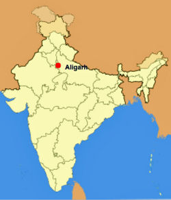
Aligarh, also known as Koil, was the headquarters of Aligarh District in the Meerut Division of United Provinces during the British period. It is situated about 75 miles south-east of Delhi. Aligarh's Civil Station lay north-east of the city. The old cantonment was abolished in 1869 and the old cemetery from 1802 is near the fort.
Military history
Battle of Alighur 1803
Battle of Allygurh August 1857
Battle of Allygurh October 1857
Spelling Variants
Modern name: Aligarh
Variants: Alighur/Aligurh/Allyghur/Allygurh/Alliegurh
Railways
Aligarh was a junction between the main line of the East Indian Railway and a branch of the Oudh and Rohilkhand Railway.
Murrays Handbook 1933
Murrays 1933 Handbook lists the following for Aligarh:
Dak Bungalow: Kellner's Refreshments and Sleeping Rooms
Bank: Imperial Bank
Missions: American Methodist Episcopal, R.C., and C.M.S. Church
Petrol Stores and Motor Accessories: Edulji Bottlewala, Railway Road
External Links
Aligarh City Imperial Gazetteer
Historical books online
- Anecdotes and Reminiscences of Service in Bengal [by A. L. M. Phillips (Alfred Lisle March Phillips) 1878] Google Books. He arrived in India in 1846 and retired 1873. The author was appointed Civil and Criminal Judge of Allyghur at the end of 1866 (page 171).