| The Families In British India Society (FIBIS) is a self-help organisation devoted to members researching their British India family history and the background against which their ancestors led their lives in India under British rule. Let FIBIS help you break down those brick walls in your research |
Ranikhet: Difference between revisions
Jump to navigation
Jump to search
New Page |
add image |
||
| Line 1: | Line 1: | ||
{{Locations_Infobox | {{Locations_Infobox | ||
|presidency=[[Bengal (Presidency)|Bengal]] | |presidency=[[Bengal (Presidency)|Bengal]] | ||
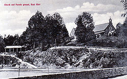
|image= | |image=Church and Parade Ground Ranikhet.jpg | ||
|coordinates= [http://maps.google.com/maps?t=h&q=29.65,79.42&ie=UTF8&ll=29.65,79.42&spn=0.105324,0.209427&z=12 29.65°N 79.42°E] | |coordinates= [http://maps.google.com/maps?t=h&q=29.65,79.42&ie=UTF8&ll=29.65,79.42&spn=0.105324,0.209427&z=12 29.65°N 79.42°E] | ||
|altitude= 1,869 m (6,132 ft) | |altitude= 1,869 m (6,132 ft) | ||
| Line 10: | Line 10: | ||
[[Ranikhet]] is an important military hill station. | [[Ranikhet]] is an important military hill station. | ||
[[File:Station Dairy Ranikhet.jpg|thumb|left|Station Dairy at Ranikhet]] | |||
[[Category:Cities, towns and villages in Bengal Presidency]] | [[Category:Cities, towns and villages in Bengal Presidency]] | ||
[[Category:Locations]] | [[Category:Locations]] | ||
[[Category:Hill Stations]] | [[Category:Hill Stations]] | ||
Revision as of 10:27, 28 April 2011
| Ranikhet | |
|---|---|

| |
| Presidency: Bengal | |
| Coordinates: | 29.65°N 79.42°E |
| Altitude: | 1,869 m (6,132 ft) |
| Present Day Details | |
| Place Name: | Ranikhet |
| State/Province: | Uttarakhand |
| Country: | India |
| Transport links | |
Ranikhet is an important military hill station.
