| The Families In British India Society (FIBIS) is a self-help organisation devoted to members researching their British India family history and the background against which their ancestors led their lives in India under British rule. Let FIBIS help you break down those brick walls in your research |
Ranikhet: Difference between revisions
Jump to navigation
Jump to search
No edit summary |
m rework external link (Church) |
||
| Line 19: | Line 19: | ||
Ranikhet, Rani Khet, Raniket, Rhaniket<br> | Ranikhet, Rani Khet, Raniket, Rhaniket<br> | ||
Chaubattia, Chaubatia, Chaubathia | Chaubattia, Chaubatia, Chaubathia | ||
==Churches== | |||
* St Bridget's Church, Chaubattia (Built 1884). <ref> [http://bareillydiocese.org/chaubattia/ bareillydicese.org]</ref> | |||
==External links== | ==External links== | ||
| Line 26: | Line 31: | ||
*[http://www.livemint.com/Opinion/i4ZwATS1x18HRrRK1pWDOL/Ranikhet-the-Raj-relived.html Ranikhet: the Raj relived] by Saionton Basu 22 July 2009 livemint.com | *[http://www.livemint.com/Opinion/i4ZwATS1x18HRrRK1pWDOL/Ranikhet-the-Raj-relived.html Ranikhet: the Raj relived] by Saionton Basu 22 July 2009 livemint.com | ||
*[https://web.archive.org/web/20070716230304/http://www.holmfarmranikhet.com/story.htm Holm Farm, Ranikhet], now an archived webpage | *[https://web.archive.org/web/20070716230304/http://www.holmfarmranikhet.com/story.htm Holm Farm, Ranikhet], now an archived webpage | ||
*[http://www.stamps-auction.com/india-old-postcard-married-quarters-barracks-ranikhet-for-sale-105513 Postcard: Married Quarters and Half Noon Barracks in Snow, Ranikhet] stamps-auction.com | *[http://www.stamps-auction.com/india-old-postcard-married-quarters-barracks-ranikhet-for-sale-105513 Postcard: Married Quarters and Half Noon Barracks in Snow, Ranikhet] stamps-auction.com | ||
Revision as of 16:37, 12 January 2014
| Ranikhet | |
|---|---|

| |
| Presidency: Bengal | |
| Coordinates: | 29.65°N 79.42°E |
| Altitude: | 1,869 m (6,132 ft) |
| Present Day Details | |
| Place Name: | Ranikhet |
| State/Province: | Uttarakhand |
| Country: | India |
| Transport links | |

Ranikhet is an important military hill station and was in the District and tahsil of Almora, United Provinces
"The Cantonment comprises Ranikhet proper, Kumpoor, Chaubattia and the standing camp also known as Dulikhet and is about 6 km long with an average breadth of 8 miles and has an area of 4,262.61 acres. ...In 1868, the site was selected for stationing British Troops and the following year the Cantonment was established"[1]
Chaubattia is situated about 7 km from Ranikhet.
Spelling variants
Ranikhet, Rani Khet, Raniket, Rhaniket
Chaubattia, Chaubatia, Chaubathia
Churches
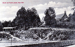
- St Bridget's Church, Chaubattia (Built 1884). [2]
External links
- Ranikhet Wikipedia
- Ranikhet Revisted Article dated 28 May 1989 by Gitanjali Prasad, now an archived webpage
- Ranikhet in the Himalayas jimcorbettnationalpark.com
- Ranikhet: the Raj relived by Saionton Basu 22 July 2009 livemint.com
- Holm Farm, Ranikhet, now an archived webpage
- Postcard: Married Quarters and Half Noon Barracks in Snow, Ranikhet stamps-auction.com
Historical books online
- "Ranikhet" Imperial Gazetteer of India, Volume 21, page 233.
References
- ↑ Pre 20th Century History of Ranikhet meriyatrra.com
- ↑ bareillydicese.org