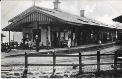
Kurseong: Difference between revisions
Jump to navigation
Jump to search
Symorsebrown (talk | contribs) Add external link & widget |
Symorsebrown (talk | contribs) Add description, spelling, widget |
||
| Line 10: | Line 10: | ||
}} | }} | ||
=== | '''Kurseong''' was a hill station in the Darjeeling District during the British period. | ||
== Spelling Variants == | |||
Modern name: Kurseong<br> | |||
Variants: Karsiang<br> | |||
===Historical books on line=== | |||
*[http://dsal.uchicago.edu/reference/gazetteer/pager.html?objectid=DS405.1.I34_V16_060.gif KureongTown] Imperial Gazetteer of India | *[http://dsal.uchicago.edu/reference/gazetteer/pager.html?objectid=DS405.1.I34_V16_060.gif KureongTown] Imperial Gazetteer of India | ||
Latest revision as of 12:59, 30 May 2016
| Kurseong | |
|---|---|

| |
| Presidency: Bengal | |
| Coordinates: | 26.88°N 88.288°E |
| Altitude: | 1,500 metres (4,900 ft) |
| Present Day Details | |
| Place Name: | Kurseong |
| State/Province: | Bengal |
| Country: | India |
| Transport links | |
| Darjeeling-Himalayan Railway | |
Kurseong was a hill station in the Darjeeling District during the British period.
Spelling Variants
Modern name: Kurseong
Variants: Karsiang
Historical books on line
- KureongTown Imperial Gazetteer of India