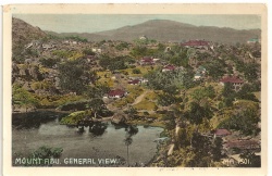
Mount Abu
| Mount Abu | |
|---|---|

| |
| Presidency: Bombay | |
| Coordinates: | 24.5925°N 72.7083°E |
| Altitude: | 1,220 m (4,000 ft) |
| Present Day Details | |
| Place Name: | Mount Abu |
| State/Province: | Rajasthan |
| Country: | India |
| Transport links | |
| Bombay, Baroda and Central India Railway | |
Spelling variants
Modern name: Mount Abu
Variants: Mount Aboo
FIBIS resources
Churches and Missions
- St Saviour's Anglican Church (previously known as St Lawrence Church) Founded 1846
- St Ann's (Roman Catholic) Founded 1870
Cemeteries
- Christian cemetery has stones dating from c 1858
Schools
- Abu Lawrence School - founded by Sir Henry Lawrence in 1856. (For more information see Fibiwiki article Lawrence Military Asylum)
- St Mary's High School - renamed in 1929 and taken over by Christian brothers. Formerly known as Mount Abu Railway School (established 1887) and originally run by Bombay, Baroda and Central Railway for children of European and Anglo- Indian railway Staff.
- Chronology from official alumni website of St May's High School, Mount Abu
- St Mary's High School 1943-1945 by Kenneth “Jock” Staynor
- Chronology from official alumni website of St May's High School, Mount Abu
Cadet Regiment
There was a cadet company at Mount Abu, part of the 2nd Battalion, Bombay, Baroda and Central India Railway Volunteer Rifles.[1] There is no mention of a cadet company in the reminiscences of Kenneth Staynor (above), so perhaps the cadet company was connected with Abu Lawrence School.
External links
- Mount Abu Wikipedia
- Rajasthan’s sole summer resort an article about Mount Abu and its main attractions by Shona Adhikari (tribuneindia.com)
Historical books online
- Abu Imperial Gazetteer of India, Volume 5, page 3.
- The Mutinies in Rajpootana, being personal narrative of the Mutiny at Nusseerabad, with subsequent residence at Jodhpore, and journey across the desert into Sind, together with an account of the outbreak at Neemuch, and mutiny of the Jodhpore Legion at Erinpoora, and attack on Mount Aboo by Iltudus Thomas Prichard. late of the Bengal Army 1860 Google Books
- "Topographical and Descriptive Account of Mount Aboo, the Station, Barracks and Hospital" by J Ogilvy, M.D. Assistant-Surgeon, 33rd Regiment, page 195 Army Medical Department: Statistical Sanitary and Medical Reports for the year 1859 (published 1861) Google Books
- The Western Rajputana States:
a medico-topographical and general account of Marwar, Sirohi, Jaisalmir
by Lieut.-Colonel Archibald Adams. 1899 Archive.org
- Mount Abu page 30. Contains a photograph of the Church, facing page 34
- Photograph of Mount Abu facing page 423
- The Journey to Mount Abu page 95 Through Rajputana to Delhi : An Ilustrated Guide to the Districts Reached by the Bombay, Baroda and Central India Railway by Carlton Stubbs 1907 Archive.org
- Annual Return Of Public Military Buildings In The Sanitarium Of Mount Abu 1924. Pdf download, Digital Library of India.
References