File list
Jump to navigation
Jump to search
This special page shows all uploaded files.
| Date | Name | Thumbnail | Size | User | Description |
|---|---|---|---|---|---|
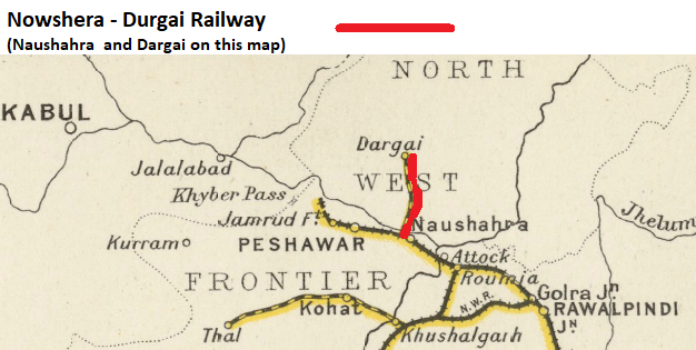
| 13:30, 3 May 2019 | Nowshera - Durgai Railway.png (file) |  |
229 KB | PEA-2292 | '''Nowshera-Durgai Railway''' From "Imperial Gazetteer of India, v. 26, Atlas 1909 edition, Railway Map--Sectional (1), p. 23." Extracted from [https://dsal.uchicago.edu/reference/gaz_atlas_1909/pager.html?object=29 Click here] and Zoomed using nav... |
| 09:24, 30 April 2019 | Khyber Pass Railway 2.png (file) |  |
415 KB | PEA-2292 | '''Khyber Pass Railway, 1931 Map''' From ‘Imperial Gazetteer of India,’ v. 26, Atlas 1931 edition, Railways & Inland Navigation, p. 24. Extracted from [http://dsal.uchicago.edu/reference/gaz_atlas_1931/fullscreen.html?object=31 Click here] and Zo... |
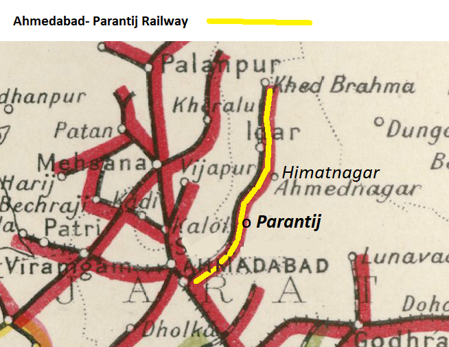
| 09:16, 27 April 2019 | Ahmedabad- Parantij Railway.png (file) |  |
429 KB | PEA-2292 | '''Ahmedabad-Parantij Railway''' From ‘Imperial Gazetteer of India,’ v. 26, Atlas 1931 edition, Railways & Inland Navigation, p. 24. Extracted from [http://dsal.uchicago.edu/reference/gaz_atlas_1931/pager.html?object=31 Click here] and Zoomed usi... |
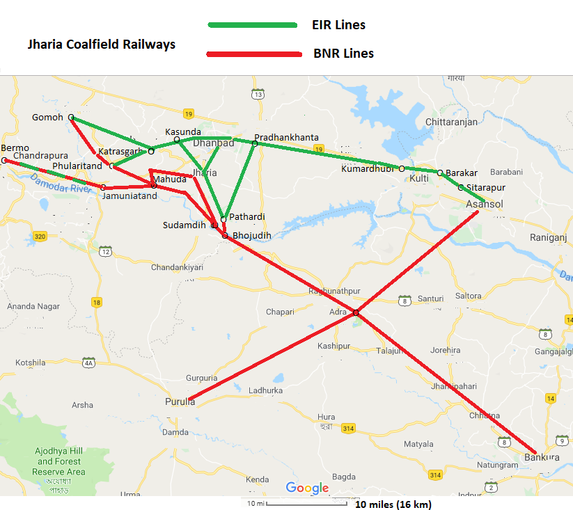
| 15:14, 24 April 2019 | Jaharia Coalfields Railways Google Map.png (file) |  |
235 KB | PEA-2292 | '''Jharia Coalfield Railways''' Map from Google Maps, marked up with line of route and place names added Category:Railway maps |
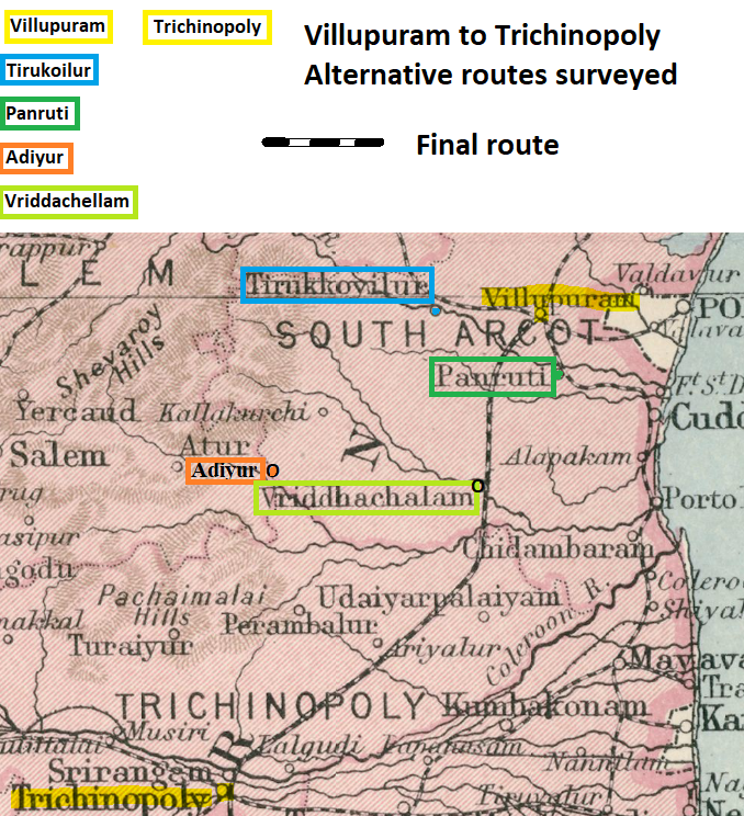
| 14:19, 10 April 2019 | Villupuram to Trichinopoly – Alternative routes surveyed.png (file) |  |
854 KB | PEA-2292 | '''Villupuram to Trichinopoly -alternative routes surveyed''' From ""1931 Provincial Map Madras Southern Section", page 43 (pdf50) Extracted from [http://dsal.uchicago.edu/reference/gaz_atlas_1931/fullscreen.html?object=50 Click here] and Zoomed usin... |
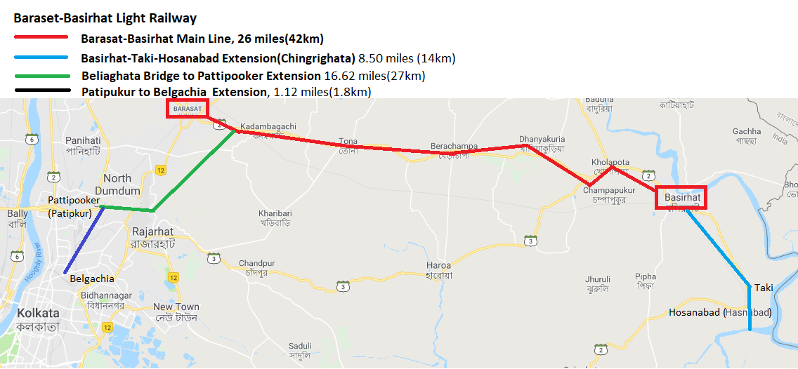
| 13:40, 10 April 2019 | Baraset-Basirhat Light Railway.png (file) |  |
216 KB | PEA-2292 | '''Barasat-Basirhat Light Railway''' Map created from 'Google Maps', marked up with approximate route of the light railway |
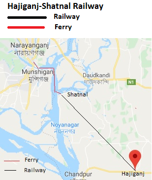
| 10:11, 1 April 2019 | Hajiganj-Shatnal Railway.png (file) |  |
132 KB | PEA-2292 | '''Hajiganj-Shatnal Railway''' Map from Google Maps, marked up with town names and line of railway and ferry. Category:Railway maps |
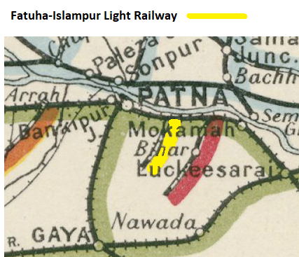
| 09:29, 16 March 2019 | Fatuha-Islampur Light Railway.png (file) |  |
224 KB | PEA-2292 | '''Fatuha-Islampur Light Railway'''From ‘Imperial Gazetteer of India,’ v. 26, Atlas 1931 edition, Railways & Inland Navigation, p. 25. Extracted from [http://dsal.uchicago.edu/reference/gaz_atlas_1931/fullscreen.html?object=32 Click here] and Zoom... |
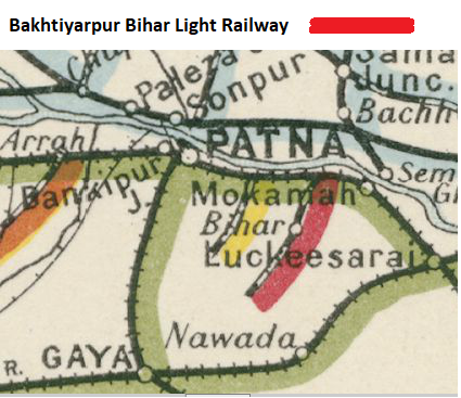
| 15:39, 15 March 2019 | Bakhtiyarpur Bihar Light Railway.png (file) |  |
285 KB | PEA-2292 | '''Bakhtiyarpur Bihar Light Railway''' From ‘Imperial Gazetteer of India,’ v. 26, Atlas 1931 edition, Railways & Inland Navigation, p. 25. Extracted from [http://dsal.uchicago.edu/reference/gaz_atlas_1931/fullscreen.html?object=32 Click here] and... |
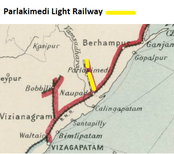
| 13:40, 15 March 2019 | Parlakimedi Light Railway.png (file) |  |
130 KB | PEA-2292 | '''Parlakimedi Light Railway''' From ‘Imperial Gazetteer of India,’ v. 26, Atlas 1931 edition, Railways & Inland Navigation, p. 25. Extracted from [http://dsal.uchicago.edu/reference/gaz_atlas_1931/fullscreen.html?object=32 Click here] and Zoomed... |
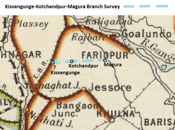
| 16:28, 14 March 2019 | Kissengunge-Kotchandpur-Magura Branch Survey.png (file) |  |
304 KB | PEA-2292 | '''Kissengunge-Kotchandpur-Magura Branch Survey''' From "Imperial Gazetteer of India, v. 26, Atlas 1909 edition, Railway Map--Sectional (2), p. 24." Extracted from [https://dsal.uchicago.edu/reference/gaz_atlas_1909/pager.html?object=30 Click here] a... |
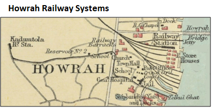
| 16:08, 12 March 2019 | Howrah Railway Systems.png (file) |  |
161 KB | PEA-2292 | |
| 15:48, 12 March 2019 | Howrah Tramways.png (file) |  |
192 KB | PEA-2292 | '''Howrah Tramways (Light Railways)''' Map from ”Two foot gauge at Howrah Maiden” by P J Bowcutt and H C Hughes. ‘Railway Magazine’ September 1965 Vol III No 773 pages 497-501 reproduced and marked-up by permission. |
| 12:23, 11 February 2019 | Hansara Tea Tramway System.png (file) |  |
61 KB | PEA-2292 | '''Hansara Tea Tramway System''' Sketch map showing relative locations of the Tea gardens grouped under Hansara by Steve Moore, Feb 2019 |
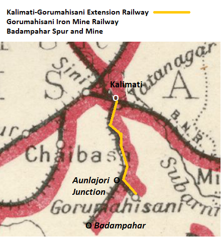
| 11:46, 10 February 2019 | Kalimati-Gorumahisani Extension Railway.png (file) |  |
255 KB | PEA-2292 | '''Kalimati-Gorumahisani Extension Railway''' From ‘Imperial Gazetteer of India,’ v. 26, Atlas 1931 edition, Railways & Inland Navigation, p. 25. Extracted from [http://dsal.uchicago.edu/reference/gaz_atlas_1931/fullscreen.html?object=32 Click he... |
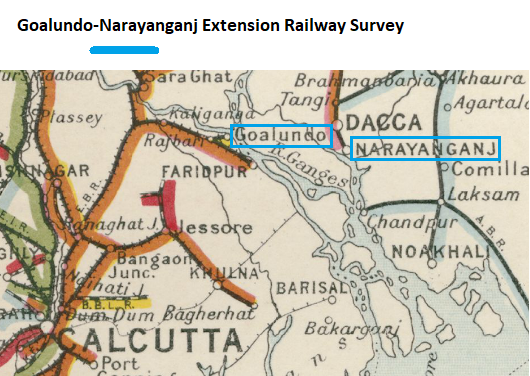
| 16:35, 9 February 2019 | Goalundo-Narayanganj Extension Railway Survey.png (file) |  |
308 KB | PEA-2292 | '''Goalundo-Narayanganj Extension Railway Survey''' From "Imperial Gazetteer of India, v. 26, Atlas 1909 edition, Railway Map--Sectional (2), p. 24." Extracted from [https://dsal.uchicago.edu/reference/gaz_atlas_1909/pager.html?object=30 Click here]... |
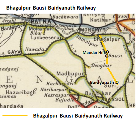
| 20:51, 3 February 2019 | Bhagalpur-Bausi-Baidyanath Railway Map.png (file) |  |
242 KB | PEA-2292 | '''Bhagalpur-Bausi-Baidyanath Railway''' From "Imperial Gazetteer of India, v. 26, Atlas 1909 edition, Railway Map--Sectional (2), p. 24." Extracted from [https://dsal.uchicago.edu/reference/gaz_atlas_1909/pager.html?object=30 Click here] and Zoomed... |
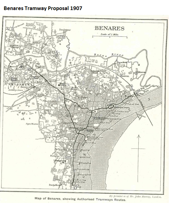
| 13:45, 31 January 2019 | Benares Tramway Proposal 1907 Map.png (file) |  |
430 KB | PEA-2292 | '''Benares Tramway, 1907 Proposal ''' Map extracted from the "Tramway and Railway World" Vol XXII Nov 1907. The map and text is reproduced by permission of the Archivist, The National Tramway Museum, Crich, Derbyshire, England. [[Category:Railway ma... |
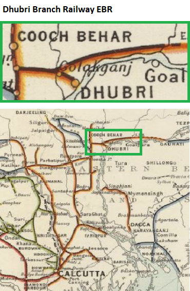
| 06:49, 20 January 2019 | Dhubri Branch Railway Map.png (file) |  |
347 KB | PEA-2292 | '''Dhubri Branch Railway''' From "Imperial Gazetteer of India, v. 26, Atlas 1909 edition, Railway Map--Sectional (2), p. 24." Extracted from [https://dsal.uchicago.edu/reference/gaz_atlas_1909/pager.html?object=30 Click here] and Zoomed using navigat... |
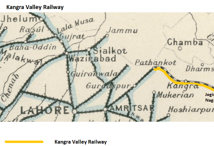
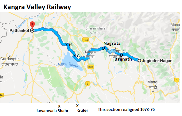
| 15:08, 17 January 2019 | Kangra Valley Railway 1931 Map v2.png (file) |  |
383 KB | PEA-2292 | == Summary == '''Kangra Valley Railway''' From ‘Imperial Gazetteer of India,’ v. 26, Atlas 1931 edition, Railways & Inland Navigation, p. 24. Extracted from [http://dsal.uchicago.edu/reference/gaz_atlas_1931/fullscreen.html?object=31 Click here]... |
| 15:04, 17 January 2019 | Kangra Valley Railway.png (file) |  |
179 KB | PEA-2292 | == Summary == '''Kangra Valley Railway''' From ‘Imperial Gazetteer of India,’ v. 26, Atlas 1931 edition, Railways & Inland Navigation, p. 24. Extracted from [http://dsal.uchicago.edu/reference/gaz_atlas_1931/fullscreen.html?object=31 Click here]... |
| 14:53, 17 January 2019 | Kangra Valley Railway 1931 Map.png (file) |  |
397 KB | PEA-2292 | '''Kangra Valley Railway''' From ‘Imperial Gazetteer of India,’ v. 26, Atlas 1931 edition, Railways & Inland Navigation, p. 24. Extracted from [http://dsal.uchicago.edu/reference/gaz_atlas_1931/fullscreen.html?object=31 Click here] and Zoomed usi... |
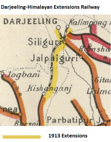
| 10:15, 15 January 2019 | Darjeeling-Himalayan Extensions Railway.png (file) |  |
224 KB | PEA-2292 | '''Darjeeling-Himalayan Extensions Railway''' From "Imperial Gazetteer of India, v. 26, Atlas 1909 edition, Railway Map--Sectional (2), p. 24." Extracted from [https://dsal.uchicago.edu/reference/gaz_atlas_1909/pager.html?object=30 Click here] and Zo... |
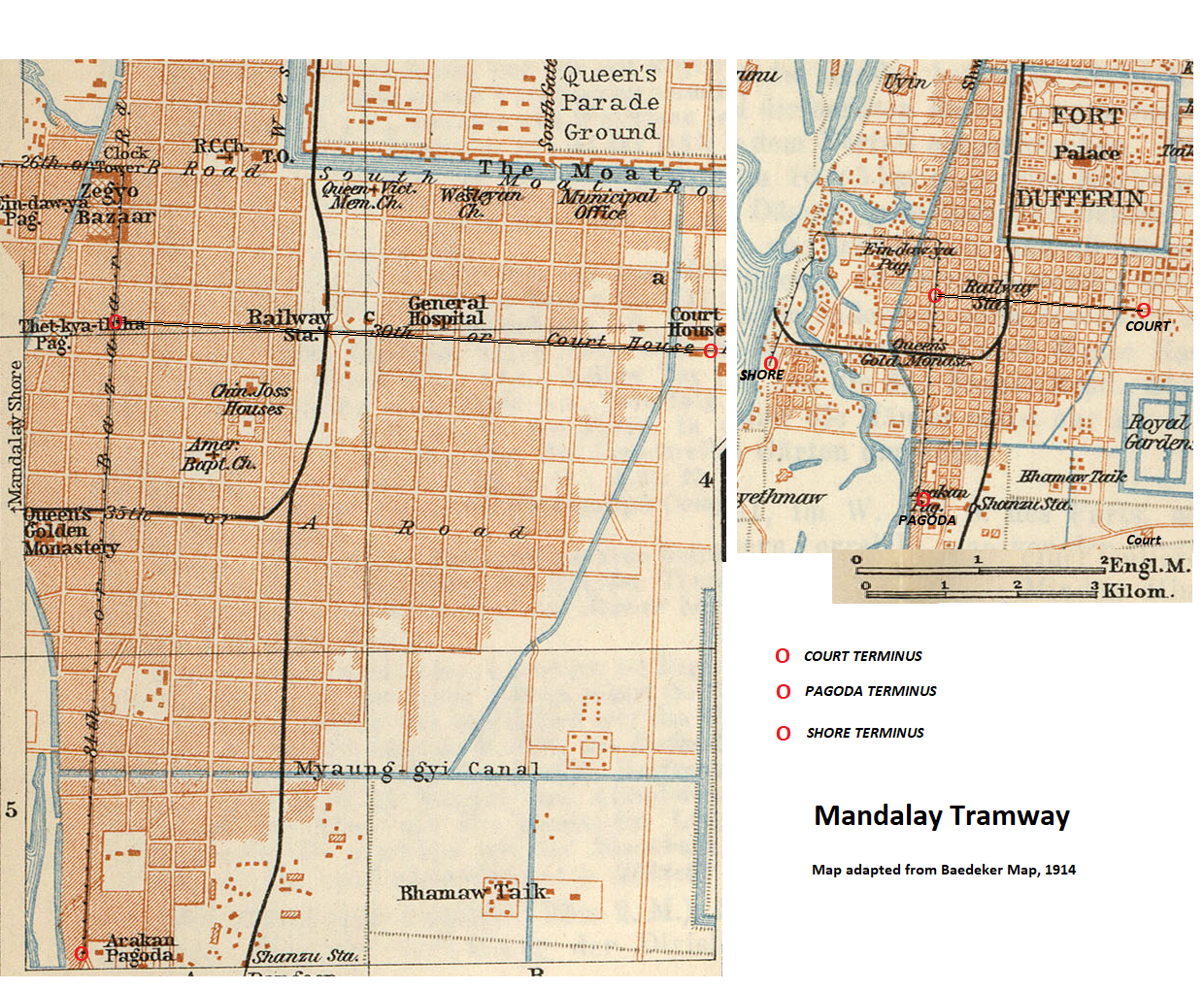
| 13:19, 13 January 2019 | Burma - Mandalay Tramway.png (file) |  |
2.56 MB | PEA-2292 | '''Burma - Mandalay Tramway''' http://legacy.lib.utexas.edu/maps/historical/baedeker_indien_1914/txu-pclmaps-mandalay_1914.jpg <br>‘Legacy Library Texas’ “Baedeke’s Indien Travel Guide, 1914” – Mandalay map from "Indien: Handbuch Für R... |
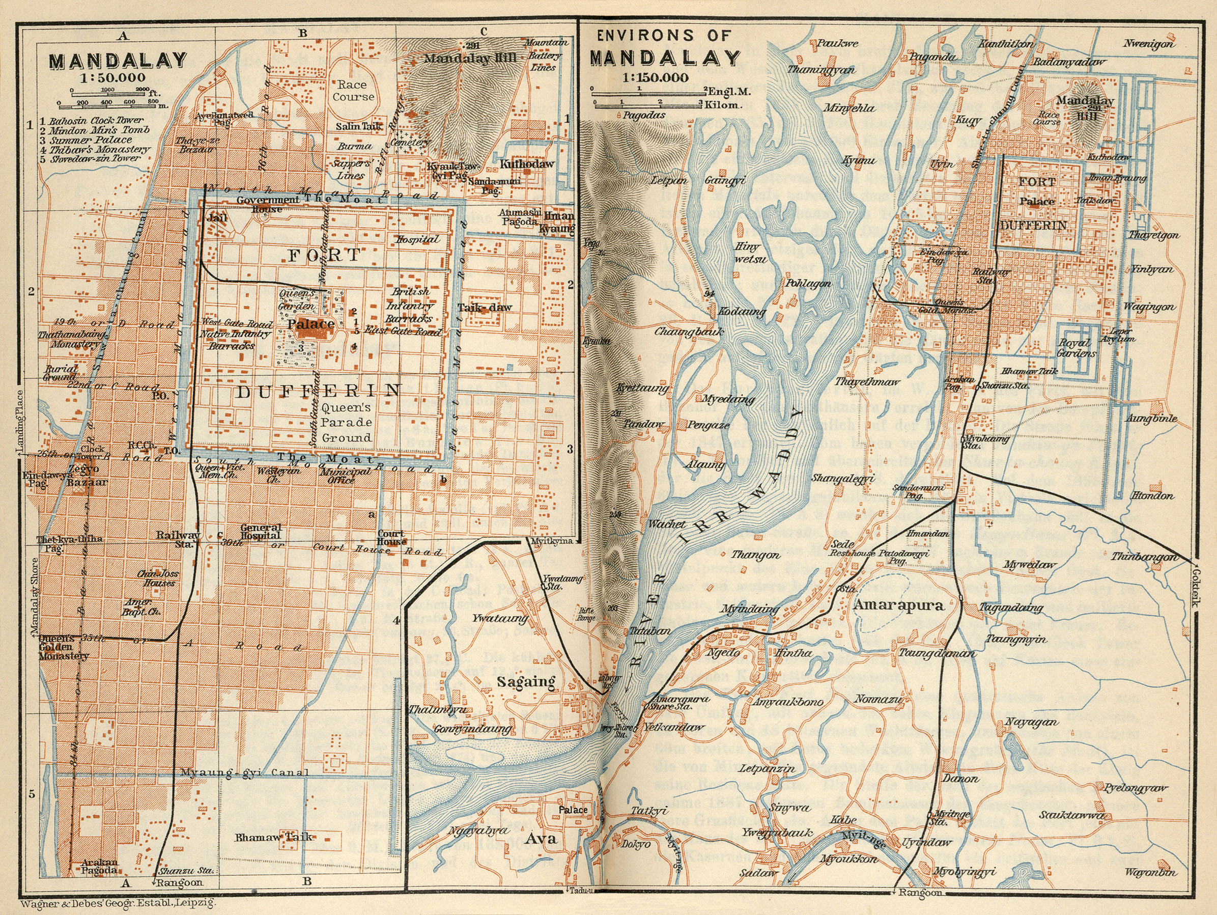
| 13:09, 13 January 2019 | Burma - Mandalay, 1914.jpg (file) |  |
1.59 MB | PEA-2292 | http://legacy.lib.utexas.edu/maps/historical/baedeker_indien_1914/txu-pclmaps-mandalay_1914.jpg ‘Legacy Library Texas’ “Baedeke’s Indien Travel Guide, 1914” – Mandalay map from "Indien: Handbuch Für Reisende" published by Verlag von Ka... |
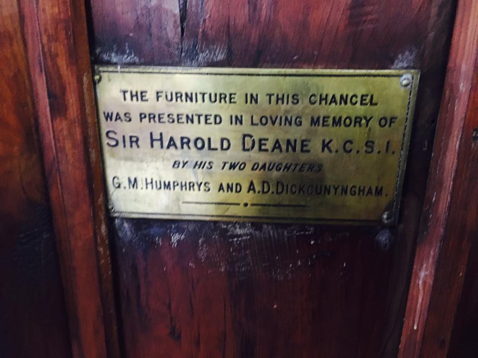
| 21:16, 14 December 2018 | Furniture presented by the daughters of Lieutenant-Colonel Sir Harold Arthur Deane KCSI.jpg (file) |  |
64 KB | Asadawan | Furniture presented by the daughters of Lieutenant-Colonel Sir Harold Arthur Deane KCSI |
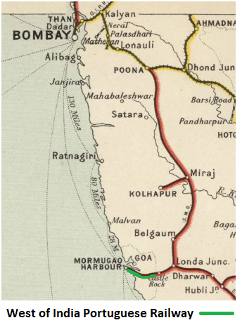
| 15:09, 25 November 2018 | West of India Portuguese Railway.png (file) |  |
215 KB | PEA-2292 | '''West of India Portuguese Railway''' From "Imperial Gazetteer of India, v. 26, Atlas 1909 edition, Railway Map--Sectional (1), p. 23." Extracted from [https://dsal.uchicago.edu/reference/gaz_atlas_1909/pager.html?object=29 Click here] and Zoomed us... |
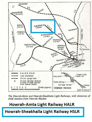
| 15:44, 19 November 2018 | Howrah-Sheakhalla Light Railway.png (file) |  |
218 KB | PEA-2292 | '''Howrah- Sheakhalla Light Railway''' Map from ”Two foot gauge at Howrah Maiden” by P J Bowcutt and H C Hughes. ‘Railway Magazine’ September 1965 Vol III No 773 pages 497-501 reproduced and marked-up by permission. |
| 15:21, 19 November 2018 | Howrah-Amta Light Railway.png (file) |  |
208 KB | PEA-2292 | '''Howrah-Amta Light Railway''' Map from ”Two foot gauge at Howrah Maiden” by P J Bowcutt and H C Hughes. ‘Railway Magazine’ September 1965 Vol III No 773 pages 497-501 reproduced and marked-up by permission. |
| 09:28, 19 November 2018 | Jamrud-Dakka-Jalabad Portable Railway.png (file) |  |
137 KB | PEA-2292 | '''Jamrud-Dakka-Jalabad Portable Railway''' From the "Narrow Gauge Magazine" No. 248 May 2018 published by The Narrow Gauge Railway Society by Richard Harrison. 'North West Frontier Map' marked up with railway lines and locations. Reproduced by permis... |
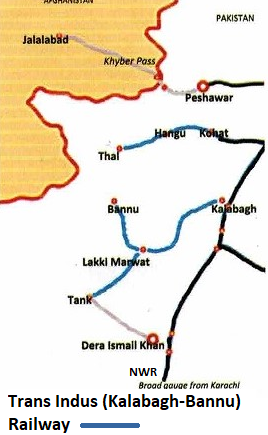
| 08:25, 19 November 2018 | Trans Indus (Kalabagh-Bannu) Railway.png (file) | 136 KB | PEA-2292 | '''Trans Indus (Kalabagh-Bannu) Railway''' From the "Narrow Gauge Magazine" No. 248 May 2018 published by The Narrow Gauge Railway Society by Richard Harrison. 'North West Frontier Map' marked up with railway lines and locations. Reproduced by permiss... | |
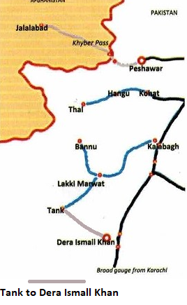
| 07:08, 19 November 2018 | Tank to Dera Ismail Khan Portable Railway.png (file) |  |
119 KB | PEA-2292 | '''Tank to Dera Ismail Khan Portable Railway''' From the "Narrow Gauge Magazine" No. 248 May 2018 published by The Narrow Gauge Railway Society by Richard Harrison. 'North West Frontier Map' marked up with railway lines and locations. Reproduced by pe... |
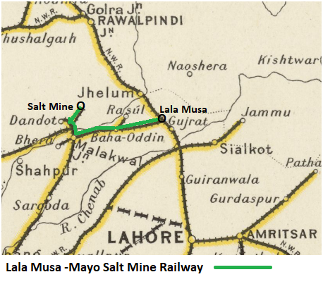
| 16:39, 18 November 2018 | Lala Musa -Mayo Salt Mine Railway.png (file) |  |
256 KB | PEA-2292 | '''Lala Musa - Mayo Salt Mine Railway (Khewra Salt Mine Railway)''' From "Imperial Gazetteer of India, v. 26, Atlas 1909 edition, Railway Map--Sectional (1), p. 23." Extracted from [https://dsal.uchicago.edu/reference/gaz_atlas_1909/pager.html?object... |
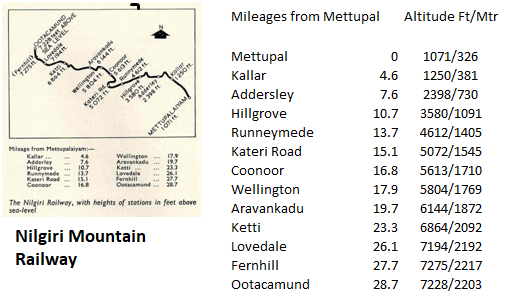
| 17:01, 17 November 2018 | Nilgiri Mountain Railway Map with mileages and altitudes.png (file) |  |
107 KB | PEA-2292 | '''Nilgiri Mountain Railway Map with mileages and altitudes''' Map from “Ascent to Ooty” by H C Hughes and P J Bawcutt, Railway Magazine November 1967 Vol 113 No 789 Transport and Technical Publications. The map is from this article with the milea... |
| 16:47, 17 November 2018 | Nilgiri Mountain Railway Map line of route.png (file) |  |
118 KB | PEA-2292 | '''Nilgiri Mountain Railway''' From Google Maps 2018, marked with line of route. [https://www.google.co.uk/search?source=hp&ei=1kXwW6b0Lq3ClwTP0YigDQ&q=nilgiri+mountain+railway&oq=&gs_l=psy-ab.1.1.35i39l6.0.0..3520...1.0..0.74.74.1......0......gws-wi... |
| 16:40, 17 November 2018 | Nilgiri Mountain Railway Map.png (file) |  |
232 KB | PEA-2292 | '''Nilgiri Mountain Railway''' From "Imperial Gazetteer of India, v. 26, Atlas 1909 edition, Railway Map--Sectional (3), p. 25." Extracted from [https://dsal.uchicago.edu/reference/gaz_atlas_1909/pager.html?object=31 Click here] and Zoomed using navi... |
| 11:39, 17 November 2018 | Matheran Light Railway - Matheran Hill.png (file) |  |
106 KB | PEA-2292 | '''Matheran Light Railway - Matheran Hill''' Map from Wikipedia "Matheran" [https://en.wikipedia.org/wiki/Matheran#/media/File:Matheran-map.jpg] |
| 09:04, 17 November 2018 | Kolar District Railway.png (file) |  |
455 KB | PEA-2292 | '''Kolar District Railway''' <br>'''Bowringpet-Kolar Railway''' From "Imperial Gazetteer of India, v. 26, Atlas 1909 edition, Railway Map--Sectional (3), p. 25." Extracted from [https://dsal.uchicago.edu/reference/gaz_atlas_1909/pager.html?object=31... |
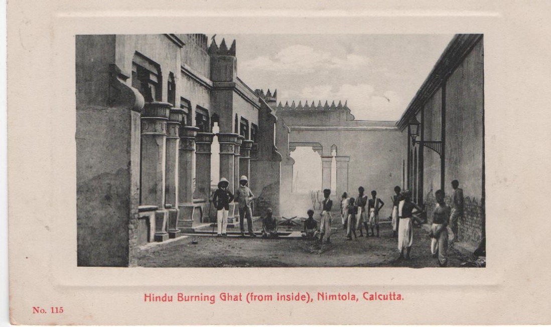
| 21:43, 16 November 2018 | Calcutta - Hindu Burning Ghat..jpg (file) |  |
167 KB | Lee | |
| 20:18, 16 November 2018 | Calcutta - Dhurumtollah Mosque.jpg.jpg (file) |  |
159 KB | Lee | |
| 19:33, 16 November 2018 | Calcutta - Dhuramtollah Mosque.gif (file) |  |
271 KB | Lee | |
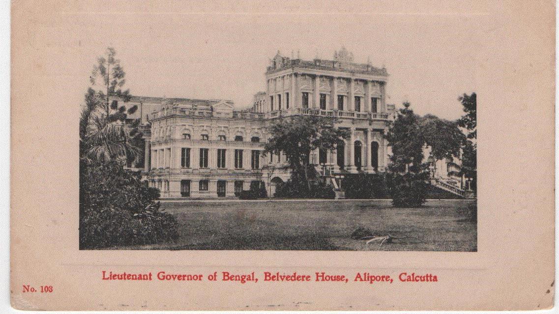
| 18:58, 16 November 2018 | Calcutta - Lt Governor Bengal Belvedere House.png (file) |  |
1.29 MB | Lee | |
| 13:47, 15 November 2018 | Dhond-Baramati Railway.png (file) |  |
154 KB | PEA-2292 | '''Dhond-Baramati Railway''' From "Imperial Gazetteer of India, v. 26, Atlas 1909 edition, Railway Map--Sectional (3), p. 25." Extracted from [https://dsal.uchicago.edu/reference/gaz_atlas_1909/pager.html?object=31 Click here] and Zoomed using navig... |
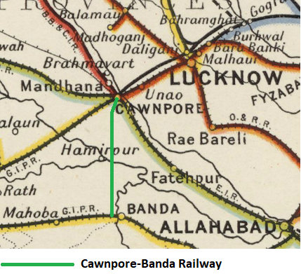
| 10:23, 10 November 2018 | Cawnpore-Banda Railway.png (file) |  |
319 KB | PEA-2292 | '''Cawnpore-Banda Railway''' From "Imperial Gazetteer of India, v. 26, Atlas 1909 edition, Railway Map--Sectional (2), p. 24." Extracted from [https://dsal.uchicago.edu/reference/gaz_atlas_1909/pager.html?object=30 Click here] and Zoomed using naviga... |
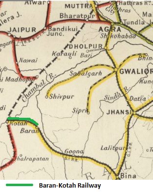
| 07:14, 10 November 2018 | Baran-Kotah Railway.png (file) |  |
222 KB | PEA-2292 | '''Baran-Kotah Railway''' From "Imperial Gazetteer of India, v. 26, Atlas 1909 edition, Railway Map--Sectional (1), p. 23." Extracted from [https://dsal.uchicago.edu/reference/gaz_atlas_1909/pager.html?object=29 Click here] and Zoomed using navigatio... |
| 06:48, 10 November 2018 | Agra-Delhi Chord Railway.png (file) |  |
122 KB | PEA-2292 | '''Agra-Delhi Chord Railway''' From "Imperial Gazetteer of India, v. 26, Atlas 1909 edition, Railway Map--Sectional (1), p. 23." Extracted from [https://dsal.uchicago.edu/reference/gaz_atlas_1909/pager.html?object=29 Click here] and Zoomed using navi... |
| 10:27, 24 June 2018 | Punjab Northern State Railway v1.png (file) |  |
377 KB | PEA-2292 | '''Punjab Northern State Railway''' From "Imperial Gazetteer of India, v. 26, Atlas 1909 edition, Railway Map--Sectional (2), p. 23." Extracted from [https://dsal.uchicago.edu/reference/gaz_atlas_1909/pager.html?object=29 Click here] and Zoomed using... |
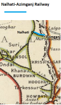
| 06:50, 23 June 2018 | Nalhati-Azimganj Railway.png (file) |  |
135 KB | PEA-2292 | '''Nalhati-Azimganj Railway''' and '''Nalhati State Railway''' From "Imperial Gazetteer of India, v. 26, Atlas 1909 edition, Railway Map--Sectional (2), p. 24." Extracted from [https://dsal.uchicago.edu/reference/gaz_atlas_1909/pager.html?object=30 C... |
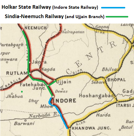
| 11:44, 10 June 2018 | Holkar and Sindia-Neemuch Railway.png (file) |  |
259 KB | PEA-2292 | '''Holkar State Railway''' marked on map in '''Blue''' <br>'''Sindia-Neemuch State Railway''' marked on map in '''Green''' From "Imperial Gazetteer of India, v. 26, Atlas 1909 edition, Railway Map--Sectional (1), p. 23." Extracted from [http://dsal.u... |
| 05:42, 7 June 2018 | Holker State Railway, 1878 from IOR.png (file) |  |
868 KB | PEA-2292 | '''Holkar State Railway, 1878''' Photographed from the ‘India Office Records’ with kind permission of the British Library Ref. IOR/V/24/3590 ; "Public Works Department: Railways, 1876-79" which contains the ‘Administration Report of the Holka... |
_Railway.png)