Kharagpur
| Kharagpur | |
|---|---|
| [[Image:|250px| ]] | |
| Presidency: Bengal | |
| Coordinates: | 22.3310478°N, 87.1924589°E |
| Altitude: | 61 m (200 ft) |
| Present Day Details | |
| Place Name: | Kharagpur |
| State/Province: | West Bengal |
| Country: | India |
| Transport links | |
| Bengal-Nagpur Railway | |
THIS PAGE IS WAITING FOR MORE DETAILED INFORMATION
Kharagpur was the headquarters subdivision of Midnapore District in the Burdwan Division of Bengal during the British period.

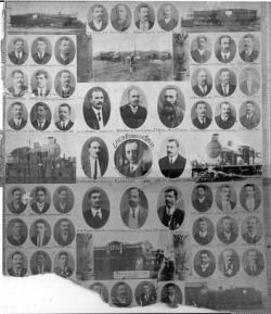
Originally it was the railway suburb of Midnapore (Medinipur), but increased in importance when BNR made it the headquarters, with workshops, of its Locomotive, Carriage and Wagon Departments
Spelling variants
Modern name: Kharagpur
Variants: Kharakpur/Khargpur
Recommended Reading
- Lines of the Nation: Indian Railway workers, Bureaucracy, and the Intimate Historical Self Columbia University Press. New York, 2007 by Laura Bear. This book is reviewed in Transport and communications reading list
External links
- Kharakpur Imperial Gazetteer
- KharagpurIndianrail.wiki. Article includes photograph of railway station
- Kharagpur’s Diaspora Reunited Website of Corinne Joy Baxter née Crampton for “friends of BNR people”. Her father was a Foreman in the Boiler Dept until they left in 1950. The website contains many photographs.
- "An American Boyhood in British India" by Stanley E Brush, born 1925. indiaofthepast.org. The author's father was an American Baptist Minister, at the American Baptist Mission at Khargpur.
- "Highlights In The Shadows" by Owen Clement, born 1928, includes memories of Kharagpur Part 4 His father’s apprenticeship, Part 10 Early Life, Part 15 Kharagpur, Part 16 Railway Institute
- Photograph of the Railway Workshop in 1909
- The Bengal-Nagpur Railway Lockout Kharagpur 1927 marxists.org
- Plan of the Railway Colony at Kharagpur page 55 The Bungalow in Twentieth-Century India by Madhavi Desai, Miki Desai, Jon Lang Google Books