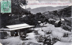
Dharampur, Himachal Pradesh
| Dharampur, Himachal Pradesh | |
|---|---|

| |
| Presidency: Bengal | |
| Coordinates: | 30.897792°N 77.0152438°E |
| Altitude: | |
| Present Day Details | |
| Place Name: | Dharampur |
| State/Province: | Himachal Pradesh |
| Country: | India |
| Transport links | |
| Kalka-Simla Railway | |
Territory of the Maharaja of Patiala and home of the King Edward Consumption Hospital