Uploads by Symorsebrown
Jump to navigation
Jump to search
This special page shows all uploaded files.
| Date | Name | Thumbnail | Size | Description |
|---|---|---|---|---|
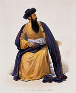
| 16:17, 27 May 2013 | 150px-Shah Shujah of Afghanistan.jpg (file) |  |
8 KB | {{Template:ImageOL |License=Wikimedia Commons |Author=Unknown |Source=Wikipedia |URL=http://en.wikipedia.org/wiki/European_influence_in_Afghanistan |Alterations=None }} |
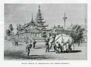
| 10:55, 13 June 2012 | Royal Palace at Amarapura.jpg (file) |  |
2.19 MB | == Summary == {{Template:ImageOL |License=[http://creativecommons.org/licenses/by-nc-nd/3.0/ Creative Commons Attribution-NonCommercial-NoDerivs 3.0] |Author=Elizabeth Hancox |Source=From 'Europe and Burma' by D.G.E.Hall. Pub.1943 |URL=n/a |Alterations= |
| 10:53, 13 June 2012 | Burmese War Boat.jpg (file) |  |
1.95 MB | == Summary == {{Template:ImageOL |License=[http://creativecommons.org/licenses/by-nc-nd/3.0/ Creative Commons Attribution-NonCommercial-NoDerivs 3.0] |Author=Elizabeth Hancox |Source=From 'Europe and Burma' by D.G.E.Hall. Pub.1943 |URL=n/a |Alterations= |
| 07:22, 13 June 2012 | Mandalay Palace terrace.jpg (file) |  |
1.36 MB | {{Template:ImageOL |License=[http://creativecommons.org/licenses/by-nc-nd/3.0/ Creative Commons Attribution-NonCommercial-NoDerivs 3.0] |Author=Elizabeth Hancox |Source=E. Hancox |URL=n/a |Alterations=none }} Category:Guns and artillery images |
| 09:00, 25 February 2012 | Production of gunpowder.jpg (file) | 180 KB | {{Template:ImageOL |Author=Elizabeth Hancox |Source=E. Hancox |URL=n/a |Alterations=none }} Category:Guns and artillery images | |
| 15:20, 20 February 2012 | Red MarkerW.png (file) |  |
1 KB | Category:Map icons |
| 15:19, 20 February 2012 | Red MarkerV.png (file) |  |
1 KB | Category:Map icons |
| 15:19, 20 February 2012 | Red MarkerU.png (file) |  |
1 KB | Category:Map icons |
| 15:18, 20 February 2012 | Red MarkerT.png (file) |  |
1 KB | Category:Map icons |
| 15:18, 20 February 2012 | Red MarkerS.png (file) |  |
1 KB | Category:Map icons |
| 12:13, 19 February 2012 | Red MarkerR.png (file) |  |
1 KB | Category:Map icons |
| 12:12, 19 February 2012 | Red MarkerQ.png (file) |  |
1 KB | Category:Map icons |
| 12:12, 19 February 2012 | Red MarkerP.png (file) |  |
1 KB | Category:Map icons |
| 12:11, 19 February 2012 | Red MarkerN.png (file) |  |
1 KB | Category:Map icons |
| 18:23, 18 February 2012 | Letter j.png (file) |  |
667 bytes | Category:Map icons |
| 17:49, 18 February 2012 | Green MarkerM.png (file) |  |
1 KB | Category:Map icons |
| 17:48, 18 February 2012 | Green MarkerL.png (file) |  |
1 KB | Category:Map icons |
| 17:48, 18 February 2012 | Green MarkerK.png (file) |  |
1 KB | Category:Map icons |
| 17:48, 18 February 2012 | Green MarkerJ.png (file) |  |
1 KB | Category:Map icons |
| 17:47, 18 February 2012 | Red MarkerM.png (file) |  |
1 KB | Category:Map icons |
| 17:47, 18 February 2012 | Red MarkerL.png (file) |  |
1 KB | Category:Map icons |
| 17:46, 18 February 2012 | Red MarkerK.png (file) |  |
1 KB | Category:Map icons |
| 17:46, 18 February 2012 | Red MarkerJ.png (file) |  |
1 KB | Category:Map icons |
| 12:09, 17 February 2012 | Green MarkerH.png (file) |  |
1 KB | Category:Map icons |
| 12:09, 17 February 2012 | Green MarkerG.png (file) |  |
1 KB | Category:Map icons |
| 12:08, 17 February 2012 | Green MarkerF.png (file) |  |
1 KB | Category:Map icons |
| 12:08, 17 February 2012 | Green MarkerE.png (file) |  |
1 KB | Category:Map icons |
| 12:08, 17 February 2012 | Green MarkerD.png (file) |  |
1 KB | Category:Map icons |
| 12:07, 17 February 2012 | Green MarkerC.png (file) |  |
1 KB | Category:Map icons |
| 12:06, 17 February 2012 | Green MarkerB.png (file) |  |
1 KB | Category:Map icons |
| 12:05, 17 February 2012 | Green MarkerA.png (file) |  |
1 KB | Category:Map icons |
| 12:05, 17 February 2012 | Red MarkerH.png (file) |  |
1 KB | Category:Map icons |
| 12:04, 17 February 2012 | Red MarkerG.png (file) |  |
1 KB | Category:Map icons |
| 12:03, 17 February 2012 | Red MarkerF.png (file) |  |
1 KB | Category:Map icons |
| 18:59, 16 February 2012 | Red MarkerE.png (file) |  |
1 KB | Category:Map icons |
| 18:59, 16 February 2012 | Red MarkerD.png (file) |  |
1 KB | Category:Map icons |
| 18:58, 16 February 2012 | Red MarkerC.png (file) |  |
1 KB | Category:Map icons |
| 18:57, 16 February 2012 | Red MarkerB.png (file) |  |
1 KB | Category:Map icons |
| 18:57, 16 February 2012 | Red MarkerA.png (file) |  |
1 KB | Category:Map icons |
| 18:28, 15 February 2012 | Letter h.png (file) |  |
577 bytes | Category:Map icons |
| 18:27, 15 February 2012 | Letter i.png (file) |  |
577 bytes | Category:Map icons |
| 18:26, 15 February 2012 | Letter g.png (file) |  |
948 bytes | Category:Map icons |
| 18:26, 15 February 2012 | Letter f.png (file) |  |
568 bytes | Category:Map icons |
| 18:25, 15 February 2012 | Letter e.png (file) |  |
567 bytes | Category:Map icons |
| 18:25, 15 February 2012 | Letter d.png (file) |  |
812 bytes | Category:Map icons |
| 18:24, 15 February 2012 | Letter c.png (file) |  |
931 bytes | Category:Map icons |
| 18:24, 15 February 2012 | Letter b.png (file) |  |
794 bytes | Category:Map icons |
| 17:42, 15 February 2012 | Letter a.png (file) |  |
905 bytes | Category:Map icons |
| 16:28, 14 February 2012 | NMR station at Ooty.jpg (file) |  |
2.51 MB | {{Template:ImageOL |License=[http://creativecommons.org/licenses/by-nc-nd/3.0/ Creative Commons Attribution-NonCommercial-NoDerivs 3.0] |Author=Sy Morse-Brown |Source=Own work |URL=n/a |Alterations=none }} Category:Nilgiri Mountain Railway |
| 16:26, 14 February 2012 | NMR tunnel.jpg (file) |  |
2.83 MB | {{Template:ImageOL |License=[http://creativecommons.org/licenses/by-nc-nd/3.0/ Creative Commons Attribution-NonCommercial-NoDerivs 3.0] |Author=Sy Morse-Brown |Source=Own work |URL=n/a |Alterations=none }} Category:Nilgiri Mountain Railway |