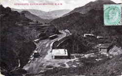
Kumaratti
| Kumaratti | |
|---|---|

| |
| Presidency: Bengal | |
| Coordinates: | 30°53'21"N 77°3'23"E |
| Altitude: | |
| Present Day Details | |
| Place Name: | Kumarhatti |
| State/Province: | Himachal Pradesh |
| Country: | India |
| Transport links | |
| Kalka-Simla Railway | |
The railway station served the Cantonment of Dagshai.
Spelling variants
- Kumarhatti