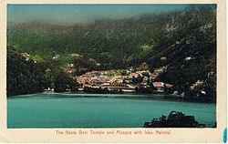
Naini Tal
| Naini Tal | |
|---|---|

| |
| Presidency: Bengal | |
| Coordinates: | 29.38°N, 79.45°E |
| Altitude: | 2,084 m (6,837 ft) |
| Present Day Details | |
| Place Name: | Nainital |
| State/Province: | Uttarakhand |
| Country: | India |
| Transport links | |
Bhim Tal , modern name Bhimtal (Wikipedia) is situated 22 kilometres from Naini Tal . It was the location of a Boer prisoner of war camp , established in 1902 at the north end of the lake, according to this link[1]
Spelling Variants
Modern name: Nainital
Variants: Nynee Tal/Naini Tal
External links
- History of Nainital and Rare Old British Era Picture Gallery Of Nainital Nainital Tourism
Historical books online
- "Naini Tal town" Imperial Gazetteer of India, Volume 18, page 333.