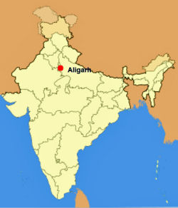
Aligarh
| Aligarh | |
|---|---|

| |
| Presidency: Bengal | |
| Coordinates: | 27.893754°N 78.068142°E |
| Altitude: | 178 m (584 ft) |
| Present Day Details | |
| Place Name: | Aligarh |
| State/Province: | Uttar Pradesh |
| Country: | India |
| Transport links | |
| East Indian Railway Oudh and Rohilkhand Railway | |
| FibiWiki Maps | |
|---|---|
| See our interactive map of this location showing places of interest during the British period | |
| [xxxxx Aligarh] |
Aligarh, also known as Koil, was the headquarters of Aligarh District in the Meerut Division of United Provinces during the British period. It is situated about 75 miles south-east of Delhi. Aligarh's Civil Station lay north-east of the city. The old cantonment was abolished in 1869 and the old cemetery from 1802 is near the fort.
Contents
Military history
Spelling Variants
Modern name: Aligarh
Variants: Alighur/Aligurh/Allyghur/Allygurh/Alliegurh
Railways
Aligarh was a junction between the main line of the East Indian Railway and a branch of the Oudh and Rohilkhand Railway.
Murrays Handbook 1933
Murrays 1933 Handbook lists the following for Aligarh:
Dak Bungalow: Kellner's Refreshments and Sleeping Rooms
Bank: Imperial Bank
Missions: American Methodist Episcopal, R.C., and C.M.S. Church
Petrol Stores and Motor Accessories: Edulji Bottlewala, Railway Road
External Links
Aligarh City Imperial Gazetteer
Historical books online
- Anecdotes and Reminiscences of Service in Bengal [by A. L. M. Phillips (Alfred Lisle March Phillips) 1878] Google Books. He arrived in India in 1846 and retired 1873. The author was appointed Civil and Criminal Judge of Allyghur at the end of 1866 (page 171).