Difference between revisions of "Girgaon"
Jump to navigation
Jump to search
Symorsebrown (talk | contribs) (Edit info box. spelling, widget, category) |
(→External links) |
||
| (One intermediate revision by one other user not shown) | |||
| Line 14: | Line 14: | ||
==Spelling variants== | ==Spelling variants== | ||
| − | + | Modern name: Girgaon<br> | |
Variants: Girgaum/Girigaum | Variants: Girgaum/Girigaum | ||
==External links== | ==External links== | ||
*[https://en.wikipedia.org/wiki/Girgaon Girgaon] Wikipedia (retrieved 13 May 2016) | *[https://en.wikipedia.org/wiki/Girgaon Girgaon] Wikipedia (retrieved 13 May 2016) | ||
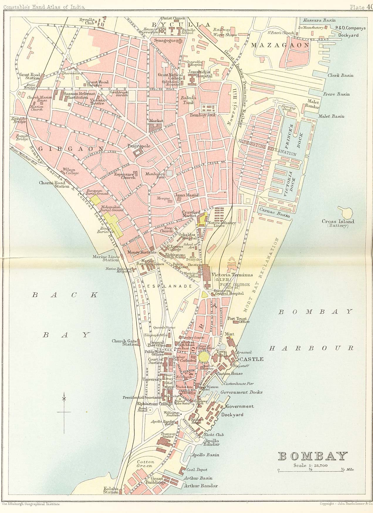
| − | *[http:// | + | *[http://sites.rootsweb.com/~poyntz/India/images/Bombay1893.jpg 1893 Map of Bombay showing Girgaon] (top left). Ian Poyntz's "Historical Maps of India" |
== References == | == References == | ||
Latest revision as of 14:25, 8 August 2018
| Girgaon | |
|---|---|
| [[Image:|250px| ]] | |
| Presidency: Bombay | |
| Coordinates: | 18.953°N 72.813°E |
| Altitude: | 12 m (39 ft) |
| Present Day Details | |
| Place Name: | Girgaon |
| State/Province: | Maharashtra |
| Country: | India |
| Transport links | |
Girgaon is an area in the southern part of Bombay City. Note: there was also a Girgaon located near Morar, Gwalior [1]
Spelling variants
Modern name: Girgaon
Variants: Girgaum/Girigaum
External links
- Girgaon Wikipedia (retrieved 13 May 2016)
- 1893 Map of Bombay showing Girgaon (top left). Ian Poyntz's "Historical Maps of India"
References