Aligarh: Difference between revisions
Jump to navigation
Jump to search
No edit summary |
No edit summary |
||
| Line 6: | Line 6: | ||
|altitude=178 m (584 ft) | |altitude=178 m (584 ft) | ||
|presentname=Aligarh | |presentname=Aligarh | ||
|stateprovince=Uttar Pradesh | |stateprovince=[http://en.wikipedia.org/wiki/Uttar_Pradesh Uttar Pradesh] | ||
|country=India | |country=India | ||
}} | }} | ||
| Line 14: | Line 14: | ||
== Murrays Handbook 1933 == | == Murrays Handbook 1933 == | ||
Murrays 1993 Handbook lists the following: | Murrays 1993 Handbook lists the following for Aligarh: | ||
'''Dak Bungalow:''' Kellner's Refreshments and Sleeping Rooms <br> | '''Dak Bungalow:''' Kellner's Refreshments and Sleeping Rooms <br> | ||
Revision as of 20:26, 7 February 2008
| Aligarh | |
|---|---|
[[Image: |250px| ]] |250px| ]]
| |
| Presidency: Bengal | |
| Coordinates: | 27.893754°N 78.068142°E |
| Altitude: | 178 m (584 ft) |
| Present Day Details | |
| Place Name: | Aligarh |
| State/Province: | Uttar Pradesh |
| Country: | India |
| Transport links | |
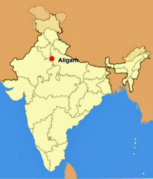
Aligarh was the scene of the Battle of Alighur 1803 in the 2nd Maratha War. It is situated about 75 miles south-east of Delhi
Aligarhs Civil Station lies north-east of the city. The old cantonment was abolished in 1869 and the old cemetery from 1802 is near the fort.
Murrays Handbook 1933
Murrays 1993 Handbook lists the following for Aligarh:
Dak Bungalow: Kellner's Refreshments and Sleeping Rooms
Bank: Imperial Bank
Missions: American Methodist Episcopal, R.C., and C.M.S. Church
Petrol Stores and Motor Accessories: Edulji Bottlewala, Railway Road