File:Presidencymap1858.jpg: Difference between revisions
Jump to navigation
Jump to search
1858 map showing the presidency boundaries. |
No edit summary |
||
| Line 1: | Line 1: | ||
1858 map showing the presidency boundaries. | 1858 map showing the presidency boundaries. | ||
[[Category:Map images]] | |||
Latest revision as of 17:44, 15 March 2008
1858 map showing the presidency boundaries.
File history
Click on a date/time to view the file as it appeared at that time.
| Date/Time | Thumbnail | Dimensions | User | Comment | |
|---|---|---|---|---|---|
| current | 18:22, 20 November 2007 | 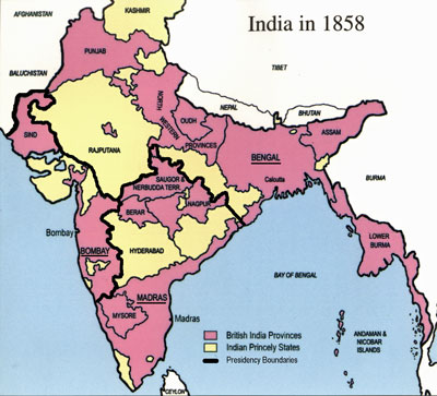 | 400 × 363 (43 KB) | Valmay (talk | contribs) | 1858 map showing the presidency boundaries. |
| 18:08, 20 November 2007 |  | 1,256 × 1,140 (115 KB) | Valmay (talk | contribs) | 1858 map showing the presidency boundaries. |
You cannot overwrite this file.
File usage
The following 3 pages use this file: