Category:Map images
Jump to navigation
Jump to search
Category for images of maps or plans relating to British India
Subcategories
This category has the following 3 subcategories, out of 3 total.
Pages in category "Map images"
The following 2 pages are in this category, out of 2 total.
Media in category "Map images"
The following 116 files are in this category, out of 116 total.
-
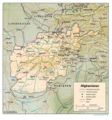 Afghanistan1993map.jpg 1,378 × 1,480; 215 KB
-
 Aliwalmap.jpg 993 × 724; 83 KB
-
 Allahganjmap.jpg 625 × 730; 188 KB
-
 Ambela-Pass.jpg 1,106 × 689; 114 KB
-
 Andaman Islands 1909 Map.png 417 × 427; 296 KB
-
 Assam.jpg 1,000 × 806; 157 KB
-
 Badowalamap.jpg 597 × 629; 108 KB
-
 Bagawallamap.jpg 622 × 671; 129 KB
-
 Baroda State Map, 1909.jpg 1,000 × 901; 265 KB
-
 Bhodiwalamap.jpg 699 × 735; 128 KB
-
 Bhowramap.jpg 1,034 × 717; 202 KB
-
 Bilwamap.jpg 600 × 590; 131 KB
-
 Bunermap.jpg 877 × 672; 150 KB
-
 Burma - Mandalay, 1914.jpg 2,391 × 1,797; 1.59 MB
-
 Calcutta map 1862 .jpg 902 × 1,413; 349 KB
-
 Carnaticwars.jpg 600 × 870; 127 KB
-
 Dagshaimap.jpg 923 × 732; 86 KB
-
 Danubyumap.jpg 511 × 680; 146 KB
-
 Deogaonmap.jpg 745 × 737; 104 KB
-
 Dhamangaonmap.jpg 686 × 568; 113 KB
-
 Dharmkotmap.jpg 698 × 734; 128 KB
-
 Dholpur State Map, 1910.png 636 × 439; 549 KB
-
 DHR 1942a.jpg 1,012 × 2,341; 75 KB
-
 DHR 1942b.jpg 1,012 × 2,341; 75 KB
-
 DHR 1942c.jpg 1,012 × 2,341; 531 KB
-
 Ferozeshahmap.jpg 1,220 × 738; 100 KB
-
 FortGulistan.jpg 508 × 293; 48 KB
-
 Fortwilliamplan.jpg 640 × 480; 115 KB
-
 Gaekwars Dabhoi Railway Maps.png 518 × 594; 251 KB
-
 Gangohmap.jpg 585 × 690; 152 KB
-
 Gawilgarhmap.jpg 749 × 736; 104 KB
-
 Gugeramap.jpg 773 × 738; 100 KB
-
 Gwaliormap.jpg 636 × 478; 202 KB
-
 Hariharpurmap.jpg 853 × 732; 117 KB
-
 Aherwamap.jpg 566 × 494; 135 KB
-
 Ahmedkhelbattle plan1880.jpg 800 × 539; 91 KB
-
 Akrabad.jpg 682 × 454; 122 KB
-
 Aligarh.jpg 468 × 547; 85 KB
-
 Allahabad.jpg 567 × 491; 139 KB
-
 Allahabadmap.jpg 976 × 678; 115 KB
-
 Almoramap.jpg 639 × 602; 147 KB
-
 Amorahmap.jpg 638 × 438; 125 KB
-
 Arakeremap.jpg 953 × 683; 83 KB
-
 Argaonmap.jpg 709 × 703; 152 KB
-
 Arrahmap.jpg 631 × 625; 75 KB
-
 Asirgarhmap.jpg 842 × 738; 110 KB
-
 Assayemap.jpg 937 × 735; 99 KB
-
 Atrauliamap.jpg 839 × 732; 124 KB
-
 Azamgarhmap.jpg 1,092 × 781; 150 KB
-
 BabaWalimap.jpg 600 × 430; 49 KB
-
 Badli-ki-Serai.jpg 881 × 738; 135 KB
-
 Bashiratganj.jpg 1,125 × 737; 130 KB
-
 Benares.jpg 861 × 940; 132 KB
-
 Betwa.jpg 832 × 693; 117 KB
-
 Bithurmap.jpg 689 × 721; 123 KB
-
 BritIndia.jpg 444 × 299; 43 KB
-
 Chandamap.jpg 638 × 553; 124 KB
-
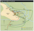
 Lucknow 1857.jpg 1,181 × 859; 134 KB
-
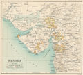
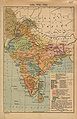
 Madras1893.jpg 997 × 1,279; 124 KB
-
 Nagpur.jpg 1,134 × 667; 147 KB
-
 Presidencies.gif 303 × 252; 14 KB
-
 Presidencymap1858.jpg 400 × 363; 43 KB
-
 Promemap.jpg 639 × 562; 68 KB
-
 Red-Fort-plan.jpg 639 × 651; 105 KB
-
 Saugor.jpg 567 × 725; 115 KB
-
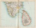 Trichinopoli&Ceylon.jpg 1,315 × 1,027; 108 KB
-
 India shepherd 1923.jpg 1,509 × 2,337; 574 KB
-
 Jouramap.jpg 1,003 × 739; 111 KB
-
 JuteMills,B.L..jpg 2,393 × 3,450; 1.85 MB
-
 Kampilmap.jpg 1,016 × 733; 102 KB
-
 Karariamap.jpg 772 × 717; 91 KB
-
 Kathiawad 1916 Map.jpg 950 × 662; 313 KB
-
 Kathiawar 1878 Map.jpg 2,492 × 1,707; 2.87 MB
-
 Kenteemap.jpg 465 × 644; 157 KB
-
 Kohat-Pass.jpg 888 × 915; 157 KB
-
 Koilmap.jpg 614 × 731; 114 KB
-
 Kolhapurmap.jpg 701 × 440; 181 KB
-
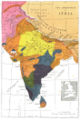 Languages of India.jpg 709 × 1,052; 210 KB
-
 Laswarimap.jpg 906 × 641; 150 KB
-
 Lucknowmap.jpg 490 × 439; 117 KB
-
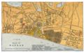 Madras map 1862.jpg 1,416 × 907; 359 KB
-
 Magadimap.jpg 850 × 595; 102 KB
-
 Maharajpurmap.jpg 499 × 383; 183 KB
-
 Malakandmap.jpg 624 × 659; 114 KB
-
 Map of Iraq by Noel Clark.JPG 1,190 × 1,347; 265 KB
-
 Map state bahawalpur.gif 700 × 600; 11 KB
-
 Map state chitral.gif 700 × 600; 11 KB
-
 Map state dir.gif 700 × 600; 11 KB
-
 Map state hunza.gif 700 × 600; 12 KB
-
 Map state kalat.gif 700 × 600; 11 KB
-
 Map state kharan.gif 700 × 600; 11 KB
-
 Map state las bela.gif 700 × 600; 11 KB
-
 Map state makran.gif 700 × 600; 11 KB
-
 Map state nagar.gif 700 × 600; 11 KB
-
 Map state phulra.gif 700 × 600; 13 KB
-
 Map state swat.gif 700 × 600; 11 KB
-
 Matiarimap.jpg 1,068 × 733; 133 KB
-
 Mohmandmap.jpg 1,020 × 753; 124 KB
-
 Munsethamap.jpg 817 × 648; 157 KB
-
 Nongtalangmap.jpg 931 × 740; 159 KB
-
 Nowsheramap.jpg 709 × 396; 135 KB
-
 Oude Province 1871.png 700 × 517; 554 KB
-
 Pandu-Nadi.jpg 966 × 809; 152 KB
-
 Panniarmap.jpg 523 × 657; 107 KB
-
 PearlRivermap.jpg 903 × 604; 79 KB
-
 Polilurmap.jpg 915 × 741; 102 KB
-
 Rasulpurmap.jpg 905 × 694; 123 KB
-
 Rasulpurmap2.jpg 593 × 736; 119 KB
-
 Rungur-Mungulmap.jpg 837 × 811; 145 KB
-
 Sabraonmap.jpg 646 × 737; 101 KB
-
 Shabkadarmap.jpg 850 × 553; 124 KB
-
 Shekh-Janamap.jpg 1,131 × 726; 140 KB
-
 Sindmap.jpg 457 × 721; 145 KB
-
 Tighramap.jpg 673 × 794; 551 KB
-
 Trichinopoly 1753.jpg 1,019 × 636; 176 KB
-
 Wanamap.jpg 798 × 601; 161 KB


