Nynee Tal: Difference between revisions
Jump to navigation
Jump to search
No edit summary |
m image added |
||
| Line 1: | Line 1: | ||
{{Locations_Infobox | {{Locations_Infobox | ||
|presidency= [[Bengal (Presidency)|Bengal]] | |presidency= [[Bengal (Presidency)|Bengal]] | ||
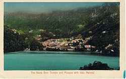
|image= | |image=The Naina Devi Temple and Mosque with lake, Nainital.jpg | ||
|coordinates= [http://maps.google.co.uk/maps?ll=29.38,79.45&z=14&t=h&hl=en 29.38°N, 79.45°E] | |coordinates= [http://maps.google.co.uk/maps?ll=29.38,79.45&z=14&t=h&hl=en 29.38°N, 79.45°E] | ||
|altitude= 2,084 m (6,837 ft) | |altitude= 2,084 m (6,837 ft) | ||
Revision as of 08:28, 17 October 2011
| Nynee Tal | |
|---|---|

| |
| Presidency: Bengal | |
| Coordinates: | 29.38°N, 79.45°E |
| Altitude: | 2,084 m (6,837 ft) |
| Present Day Details | |
| Place Name: | Nainital |
| State/Province: | Uttarakhand |
| Country: | India |
| Transport links | |
Spelling Variants
Modern name: Nainital
Variants: Nynee Tal/Naini Tal
External links
- History of Nainital and Rare Old British Era Picture Gallery Of Nainital Nainital Tourism