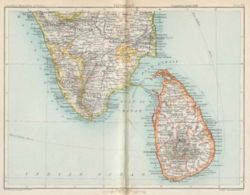
Ceylon
"Ceylon, a large island and British colony in the Indian Ocean, separated on the N.W. from India by the Gulf of Manaar and Palk Strait. It lies between 5° 55' and 9° 51' N. and between 79° 41' and 81° 54' E. Its extreme length from north to south is 2 712 m.; its greatest width is 1371 m.; and its area amounts to 25,481 sq. m., or about five-sixths of that of Ireland. In its general outline the island resembles a pear, the apex of which points towards the north."1 The island is now called Sri Lanka.

History
The Portuguese arrived in the early 16th century, followed by the Dutch in the 17th Century with the British, as usual, arriving late - 1796 - when the British East India Company established control. In 1802 Ceylon became a British Crown Colony. The island was unified in 1815 (previously there had been three kingdoms) and the island finally gained its independence in 1947.
Military actions
- 1st Kandyan War - 1803-05
- 2nd Kandyan War - 1815
- 3rd Kandyan War (Uva Rebellion) - 1817-18
Records
Except for the few short years when the East India Company was in control (1796-1802) records for Ceylon will not be found in the India Office Records at the British Library, but at The National Archives at Kew.
External links
- For additional information on Sri Lanka and its history, refer to the relevant article in Wikipedia.
- Kabristan Archives-Old Irish and Indian Graveyards has books on cemeteries in Ceylon. Volume 1 is available through the FIBIS Online Bookshop
- Macquarie University’s website Under a Tropical Sun covers the years 1796-1821. Includes the historical background and contemporary accounts of the Officers of the 73rd Regiment of Foot (and their families) in Ceylon in the years 1814-1821.
Notes
1 "Ceylon", LoveToKnow 1911 [accessed 21 October 2009].