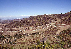
Khyber Pass
| Khyber Pass | |
|---|---|

| |
| Presidency: Bengal | |
| Coordinates: | 34.102179°N 71.121968°E |
| Altitude: | |
| Present Day Details | |
| Place Name: | Khyber Pass |
| State/Province: | Federally Administered Tribal Areas (FATA) |
| Country: | Pakistan |
| Transport links | |
The Khyber Pass connects the Pakistani province of NWFP to Afghanistan. It is currently part of Khyber Agency in the Federally Administered Tribal Areas (FATA) of Pakistan.
History
Locations within the Pass
Cemeteries
- Ali Masjid
- Landi Kotal
Forts
External Links
Khyber Pass Wikipedia Photo Gallery www.world66.com
Historical Books on-line
Khyber Imperial Gazetteer of India 1908