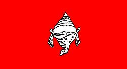
Travancore
| Travancore | |
|---|---|

| |
| Presidency: | |
| Coordinates: | 8.433333°N, 76.916667°E |
| Altitude: | |
| Present Day Details | |
| Place Name: | Districts of Kerala |
| State/Province: | Kerala |
| Country: | India |
| Transport links | |
Travancore was a princely state which was invaded by Tipu Sultan leading to the 3rd Mysore War.
External links
- Travancore Wikipedia
- Map of Travancore 1859 Wkipedia
- History of CSI Madhya Kerala Diocese by Rev. C. Y. Thomas. Includes a history of the Missions in Travancore and Cochin. Now an archived website
- Blog by pazhayathu.blogspot.co.uk dated 25 October 2010 covers several topics including
- Henry Baker was the first British CMS missionary send by the CMS to Travancore in 1819
- CMS Middle School (The present day CMS Higher Secondary School is the successor) was probably the first English school in Travancore. Buchanan Girls' school was the pioneer in Girls education.
- The "Mundakayam Peermade Motor Transport And Aerial Ropeway Co Ltd" was formed in 1914
- Archives Department Government of Kerala Records relating to the princely State of Travancore (AD1424-1885) are available at the Central Archives, Trivandrum
Historical books online
- Also see
- History of Travancore from the Earliest Times P. Shungoonny Menon 1878 Archive.org
- Letters from Malabar by Jacob Canter Visscher (now first translated from the original Dutch) to which is added An Account of Travancore and Fra Bartolomeo’s Travels in that Country by Major Heber Drury 1862 Google Books
- The Travancore State Manual Vol I by V. Nagam Aiya 1906 Archive.org