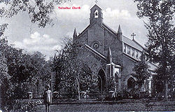
Jullundur
| Jullundur | |
|---|---|

| |
| Presidency: Bengal | |
| Coordinates: | 31.3256°N 75.5792°E |
| Altitude: | 228 m (748 ft) |
| Present Day Details | |
| Place Name: | Jalandhar |
| State/Province: | Punjab |
| Country: | India |
| Transport links | |
| FibiWiki Maps | |
|---|---|
| See our interactive map of this location showing places of interest during the British period | |
| [xxxx Jullundur] |
THIS PAGE IS WAITING FOR MORE DETAILED INFORMATION
Jullundur was the headquarters of Jullundur District in the Jullundur Division of Punjab Province during the British period. Other nearby cities include Ludhiana to the south and Amritsar to the north.
Spelling Variants
Modern spelling: Jalandhar
Variants: Jullundur/Jullunder
Miltary history
Battle of Jullundur 1857
Industry
In 1901 the town had two flour mills and a brass and iron foundry, and its trades included silk manufacture and carpentry.
Garrison
The cantonment had been established in 1846, four miles to the west of the town, and usually contained two batteries of field artillery, one battalion of British infantry, one regiment of native cavalry and a battalion of native infantry.
The Prince Consort’s Own Rifle Brigade, 3rd Battalion, was stationed there in 1892.
Photograph: No.13 Bungalow, Wellington Barracks, Jullundur, India, March 31st 1917 from Harold Bailey's Photo Album - Indian scenes from www.25thlondon.com. Note at this time the name "Wellington Barracks, Jullundur" was used.
Photograph: Jullundur - Barracks interior 1917. 25thlondon.com. Retrieved 25 August 2014
External Links
- Jullundur Town Imperial gazetteer
- Jalandhar Cantt Jalandhar Online
- History Cantonment Board Jalandhar with images of St Mary's Cathedral Church and St Luke Church