File:Muzaffargarh district.jpg
Jump to navigation
Jump to search

Size of this preview: 339 × 600 pixels. Other resolution: 565 × 1,000 pixels.
Original file (565 × 1,000 pixels, file size: 44 KB, MIME type: image/jpeg)
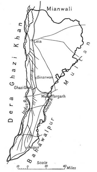
Map of Muzaffargarh District, Punjab. early 20th century
| Image Origin and License | |
|---|---|
| License: | Public Domain |
| Author: | Unknown |
| Source: | Taken from the book, The Panjab, North-West Frontier Province, and Kashmir by Sir James McCrone Douie, 1916 |
| URL of original file: | http://www.gutenberg.org/etext/24562 |
| Alterations: | none |
| See this template and instructions | |
File history
Click on a date/time to view the file as it appeared at that time.
| Date/Time | Thumbnail | Dimensions | User | Comment | |
|---|---|---|---|---|---|
| current | 09:00, 3 November 2009 | | 565 × 1,000 (44 KB) | Rzafar (talk | contribs) | Map of Muzaffargarh District, Punjab. early 20th century {{Template:ImageOL |License= Public Domain |Author= Unknown |Source= Taken from the book, The Panjab, North-West Frontier Province, and Kashmir by Sir James McCrone Douie, 1916 |URL= http:/ |
You cannot overwrite this file.
File usage
The following page uses this file: