Ootacamund
| Ootacamund | |
|---|---|

| |
| Presidency: Madras | |
| Coordinates: | 11.38°N, 76.7°E |
| Altitude: | 2,486 m (8,156 ft) |
| Present Day Details | |
| Place Name: | Udhagamandalam |
| State/Province: | Tamil Nadu |
| Country: | India |
| Transport links | |
| FibiWiki Maps | |
|---|---|
| See our interactive map of this location showing places of interest during the British period | |
| [xxxxx Ootacamund] |
THIS PAGE IS WAITING FOR MORE DETAILED INFORMATION
Ootacamund, now frequently known as Ooty (but officially called Udhagamandalam), is a town in the Nilgiri Hills. Ooty was the Madras Presidency summer capital and the headquarters of the Nilgiris District. It was founded in the 1820s by John Sullivan (1788 -1855). Lovedale is an area to the south west of the town where the Lawrence Asylum is located.
The cantonment at Wellington is situated about eight miles from Ootacamund, and one and a half miles north of Coonoor. Until 1860, the cantonment was known as Jackatalla (spelling variants: Jackatallah, Jakkatalla, Jakatala).
Keti (Kaiti) three miles south-east of Ootacamund was the location of a Boer prisoner of war camp from March 1902 to August 1902, when the prisoners were repatriated.[1]
Spelling variants
Modern spelling: Udhagamandalam
Variants: Ootacamund/Ooty/Utakamand
FIBIS resources
Schools and institutions
Related aricles
External links
- Ootacamund Town Imperial Gazetteer
- Kae Lewis website - Photographs of monuments at St Stephens Church, Ootacamund with many biographical details
- History of St Stephens Church - in Ooty since 1829 Official church website, now archived.
- "One Man's Ooty" by Mukund Padmanabhan January 16, 2005 The Hindu. John Sullivan was Ootacamund’s founder.
- Wiele & Klein, Madras and Ootacamund
- Wiele & Klein Studio Advertisement A Trade advertisement for the Madras and Ootacamund studio of Wiele & Klein, "Artists, Photographers and Photo Engravers" britishphotohistory.ning.com
- "The German Photographers of Madras" by Gabrielle Landwehr Part 1 , Part 2 (scroll down) Madras Musings Volume XVIII No. 14, November 1-15, 2008 and No. 15, November 16-30, 2008
- Madras on glass 9 July 2003 The Hindu
- Illustration: New barracks, near Coonoor 1852 British Library Online Gallery
- Illustration: "Constructing the Jackatalla Barracks, near Ootacamund Neilgherry Hills," from the Illustrated London News 1858 indiasfirstwarofindependance1857.blogspot.com
- "Wellington Of Yesteryears" dssc.gov.in (Defence Services Staff College). Now an archived webpage.
- Wellington Gymkhana Club: History It commenced in 1873 as a garrison club to offer recreation and relaxation to the garrison stationed at Wellington. Now an archived webpage.
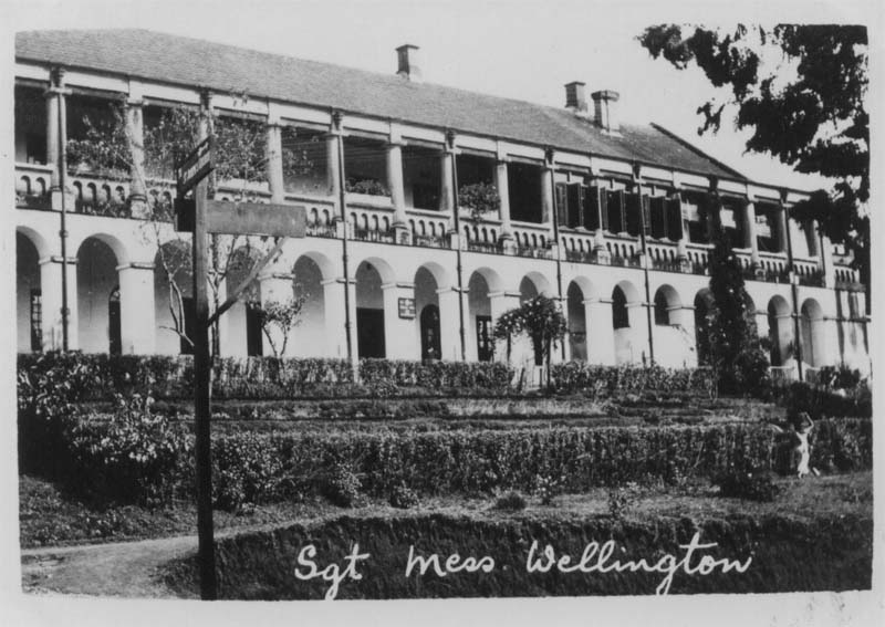
- Photograph: Sgt's Mess at Wellington India 1928 from 2nd Bn XX The Lancashire Fusiliers Wellington India 1927 – 1931 www.lancs-fusiliers.co.uk
- Photograph of British Army married quarters- Bazzar Hill, Wellington, Nilgiri Hills 1945/6 FIBIS on Facebook
- Tamil Nadu, Wellington: Cantonment in the clouds by Sneha Nagesh September 23, 2011 livemint.com
Historical books online
- "Ootacamund" page 357 Madras District Gazetteers: The Nilgiris by W Francis 1908 Archive.org
- "Map of Ootacamund" between pages 412 and 413, A Handbook for Travellers in India, Burma, and Ceylon published by John Murray, London Eighth Edition 1911 Archive.org.
- Ootacamund, A History by Sir Frederick Price 1908 is available to read online on the Digital Library of India website. The Contents page of the book is computer page 17. Refer Online books-Digital Library of India for more details about this site.
- The Magic Mountains: Hill Stations and the British Raj by Dane Kennedy, 1996 University of California Press
- "Wellington" page 341 Madras District Gazetteers: The Nilgiris by W Francis 1908 Archive.org
- "Medico-Topographical and Statistical Report of the Convalescent Depot at Wellington, Madras for the year 1870" by Assistant Surgeon Davidson MD, Royal Horse Artillery, pages 474-5 missing, text from page 476, and then from page 477, (with a number of blank pages in between) Army Medical Department: Report for the Year 1870 Volume 12 published 1872 Archive.org
References