File:Integrated Transport Proposal 1836 Line 2+3b.png
Integrated_Transport_Proposal_1836_Line_2+3b.png (582 × 475 pixels, file size: 438 KB, MIME type: image/png)
Summary
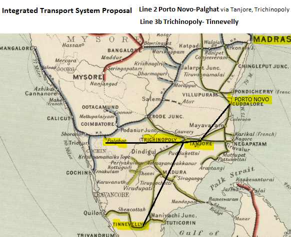
Integrated Transport System Proposal 1836 - Line 2 and Line 3b
Map extracted from Imperial Gazetteer of India, v. 26, 1909, Railway Map-Section 1, p. 24.
Extracted from Click here and Zoomed using navigation window
This map shows actual railways that were constructed.
The route proposed in the Report is shown as solid straight black lines between the locations mentioned in the report.
Licensing
|
|
This work is licensed under the Creative Commons Attribution 3.0 unported License. Specific Attribution: None specified Anyone may use this image for any purpose provided it is attributed as specified. |

File history
Click on a date/time to view the file as it appeared at that time.
| Date/Time | Thumbnail | Dimensions | User | Comment | |
|---|---|---|---|---|---|
| current | 12:58, 28 November 2016 | | 582 × 475 (438 KB) | PEA-2292 (talk | contribs) | '''Integrated Transport System Proposal 1836 - Line 2 and Line 3b''' Map extracted from Imperial Gazetteer of India, v. 26, 1909, Railway Map-Section 1, p. 24. Extracted from [http://dsal.uchicago.edu/reference/gaz_atlas_1909/pager.html?object=29 C... |
You cannot overwrite this file.
File usage
The following page uses this file: