File:Plan of Madras and its environs, 1854 v3.png
Size of this preview: 800 × 578 pixels. Other resolution: 825 × 596 pixels.
Original file (825 × 596 pixels, file size: 444 KB, MIME type: image/png)
Summary
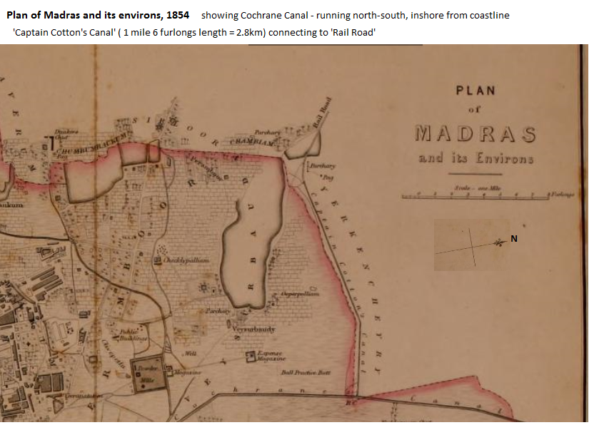
Plan of Madras and its Environs 1854
Part of the Map of Madras. Constables Atlas of India Cottons canal shown at the top and the line of the railroad
"Constables Atlas of India", 1854, Plate 41 Cottons canal shown at the top and the line of the railroad
Licensing
|
|
This work is licensed under the Creative Commons Attribution 3.0 unported License. Specific Attribution: None specified Anyone may use this image for any purpose provided it is attributed as specified. |

File history
Click on a date/time to view the file as it appeared at that time.
| Date/Time | Thumbnail | Dimensions | User | Comment | |
|---|---|---|---|---|---|
| current | 07:31, 23 December 2016 | | 825 × 596 (444 KB) | PEA-2292 (talk | contribs) | '''Plan of Madras and its Environs 1854''' Part of the Map of Madras. Constables Atlas of India Cottons canal shown at the top and the line of the railroad "Constables Atlas of India", 1854, Plate 41 Cottons canal shown at the top and the line of th... |
You cannot overwrite this file.
File usage
The following page uses this file: