File:Baraset-Basirhat Light Railway.png

Size of this preview: 800 × 370 pixels. Other resolution: 1,136 × 526 pixels.
Original file (1,136 × 526 pixels, file size: 216 KB, MIME type: image/png)
Summary
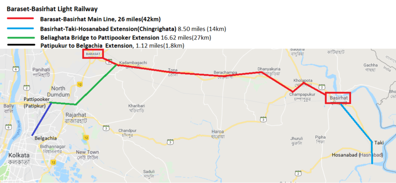
Barasat-Basirhat Light Railway
Map created from 'Google Maps', marked up with approximate route of the light railway
Licensing
|
|
This work is licensed under the Creative Commons Attribution 3.0 unported License. Specific Attribution: None specified Anyone may use this image for any purpose provided it is attributed as specified. |

File history
Click on a date/time to view the file as it appeared at that time.
| Date/Time | Thumbnail | Dimensions | User | Comment | |
|---|---|---|---|---|---|
| current | 13:40, 10 April 2019 | | 1,136 × 526 (216 KB) | PEA-2292 (talk | contribs) | '''Barasat-Basirhat Light Railway''' Map created from 'Google Maps', marked up with approximate route of the light railway |
You cannot overwrite this file.
File usage
The following page uses this file: