File:Karachi Tram Map.jpg
Size of this preview: 800 × 583 pixels. Other resolution: 896 × 653 pixels.
Original file (896 × 653 pixels, file size: 306 KB, MIME type: image/jpeg)
Summary
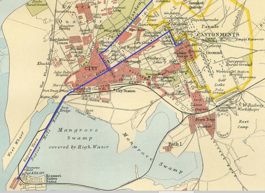
Karachi Tramway Map – Routes marked in Blue
From ‘Imperial Gazetteer of India,’ v. 26, Atlas 1931 edition, Railways & Inland Navigation, p. 66.
Extracted from Click here and Zoomed using navigation window. Marked up with route of railway
Licensing
|
|
This work is licensed under the Creative Commons Attribution 3.0 unported License. Specific Attribution: None specified Anyone may use this image for any purpose provided it is attributed as specified. |

File history
Click on a date/time to view the file as it appeared at that time.
| Date/Time | Thumbnail | Dimensions | User | Comment | |
|---|---|---|---|---|---|
| current | 15:39, 17 October 2020 | | 896 × 653 (306 KB) | PEA-2292 (talk | contribs) | '''Karachi Tramway Map''' – Routes marked in Blue From ‘Imperial Gazetteer of India,’ v. 26, Atlas 1931 edition, Railways & Inland Navigation, p. 66. Extracted from [http://dsal.uchicago.edu/reference/gaz_atlas_1931/fullscreen.html?object=73 Cl... |
You cannot overwrite this file.
File usage
The following page uses this file: