Ajmer
Jump to navigation
Jump to search
| Ajmer | |
|---|---|

| |
| Presidency: Bengal | |
| Coordinates: | 26.441°N 74.641°E |
| Altitude: | 486 m (1,594 ft) |
| Present Day Details | |
| Place Name: | Ajmer |
| State/Province: | Rajasthan |
| Country: | India |
| Transport links | |
| Rajputana-Malwa State Railway Bombay, Baroda and Central India Railway | |
| FibiWiki Maps | |
|---|---|
| See our interactive map of this location showing places of interest during the British period | |
| [xxxxx Ajmer] |
Contents
THIS PAGE IS WAITING FOR MORE DETAILED INFORMATION
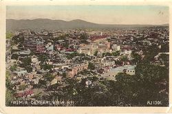
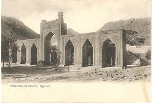
Ajmer City was the administrative headquarters of Ajmer District in the province of Ajmer-Merwara. It is now the largest city in Rajasthan.
Spelling variants
Modern name: Ajmer
Variants: Ajmere / Ajaymeru / Ajmeer
Related articles
Army
There was a cantonment at Ajmer, and elsewhere in the province at Nasirabad (14 miles away) and Deoli. Further details are given in this link[1]
Volunteers
"Ajmer is the head-quarters of the 2nd Battalion, Bombay, Baroda and Central India Railway Volunteer Rifles. The corps originally formed part of the Agra Volunteer Rifle Corps, with the title of Rajputana-Malwa Volunteer Rifle Corps. In 1887 its title was changed to the present designation. It consists of 11 companies, including a cadet company at Mount Abu. Its strength in 1903 stood at 344".[2]
External links
- 1879-Mayo College, Ajmer archiseek.com
- Ajmer 1933-40 Life in a railway colony from An Indian Childhood by Eugene Blanchette born 1933 from his website.
- My Indian summer The author’s mother lived in Ajmer, where her father was a senior railway foreman, until Independence. www.guardian.co.uk 22 October 2011
Historical books online
- "Ajmer City" Imperial Gazetteer of India, Volume 5, page 170.
- "Ajmer-Merwara Province". Imperial Gazetteer of India, Volume 5, page 137.
- Some Account of the General and Medical Topography of Ajmeer by Assistant Surgeon Robert Hamilton Irvine 1841 Google Books
References
- ↑ "Army: Ajmer- Merwara Province" Imperial Gazetteer of India, Volume 5, page 165.
- ↑ Page 122 Rajputana District Gazetteers: Volume I-A Ajmer Merwara by C C Watson, ICS 1904 Archive.org
