Jalapahar
Jump to navigation
Jump to search
| Jalapahar | |
|---|---|

| |
| Presidency: Bengal | |
| Coordinates: | 27.0487769°N 88.2735335°E |
| Altitude: | 2,298 m (7,540 ft) |
| Present Day Details | |
| Place Name: | Jalapahar |
| State/Province: | West Bengal |
| Country: | India |
| Transport links | |
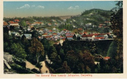
Jalapahar was a military cantonment near Darjeeling.
External links
Jalapahar Imperial Gazetteer