File:Gaekwars Dabhoi Railway Maps.png: Difference between revisions
Jump to navigation
Jump to search
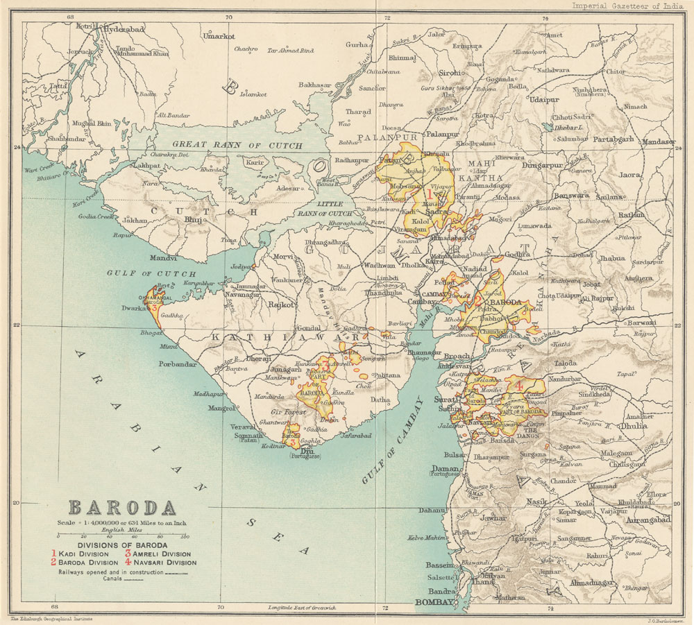
'''Gaekwars Dabhoi Railway Maps''' 1909 Map extracted from - from "Imperial Gazetteer of India, 1909" Vol 7. p.64 To see original image [http://dsal.uchicago.edu/maps/gazetteer/images/gazetteer_V7_-pg64.jpg Click here] Google Maps 2016, with added... |
(No difference)
|
Latest revision as of 15:32, 13 October 2016
Summary
Gaekwars Dabhoi Railway Maps
1909 Map extracted from - from "Imperial Gazetteer of India, 1909" Vol 7. p.64
To see original image Click here
Google Maps 2016, with added place names and railway lines
Licensing
|
|
This work is licensed under the Creative Commons Attribution 3.0 unported License. Specific Attribution: None specified Anyone may use this image for any purpose provided it is attributed as specified. |

File history
Click on a date/time to view the file as it appeared at that time.
| Date/Time | Thumbnail | Dimensions | User | Comment | |
|---|---|---|---|---|---|
| current | 15:32, 13 October 2016 | 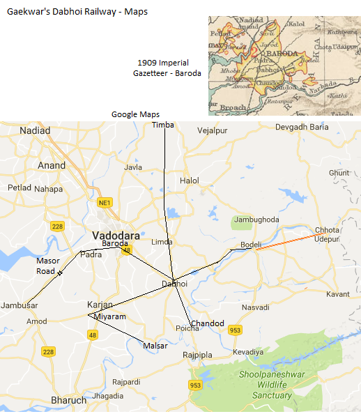 | 518 × 594 (251 KB) | PEA-2292 (talk | contribs) | '''Gaekwars Dabhoi Railway Maps''' 1909 Map extracted from - from "Imperial Gazetteer of India, 1909" Vol 7. p.64 To see original image [http://dsal.uchicago.edu/maps/gazetteer/images/gazetteer_V7_-pg64.jpg Click here] Google Maps 2016, with added... |
You cannot overwrite this file.
File usage
The following page uses this file: