Khyber Pass
| Khyber Pass | |
|---|---|

| |
| Presidency: Bengal | |
| Coordinates: | 34.102179°N 71.121968°E |
| Altitude: | |
| Present Day Details | |
| Place Name: | Khyber Pass |
| State/Province: | Federally Administered Tribal Areas (FATA) |
| Country: | Pakistan |
| Transport links | |
Alternative spelling: Khaibar Pass, Khaiber Pass
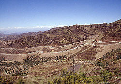
The Khyber Pass connects the Pakistani province of NWFP to Afghanistan. It is currently part of Khyber Agency in the Federally Administered Tribal Areas (FATA) of Pakistan.
History
Locations within the Pass
Cemeteries
- Ali Masjid
- Landi Kotal
Forts
External Links
- Khyber Pass Wikipedia
- Photo Gallery www.world66.com
- View Of The Khyber Pass From Shagai Fort from the second album of Private J W Linley of the 2nd Battalion, The Northamptonshire Regiment compiled whilst serving in India 1923-1938. flickr.com
- Postcard of Shagai Fort with the Khyber Hills in the background NWFP mattoid.com
- Photographs taken in the 1920s from the Lynch Album, British Museum. The photographer was Hugh Dermot Lynch who served with the North Western Railway as a Transportation Officer
Historical Books on-line
- Khyber Imperial Gazetteer of India 1908