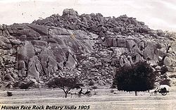
Bellary
| Bellary | |
|---|---|

| |
| Presidency: Madras (Presidency) | |
| Coordinates: | 15.150000°N, 76.933300°E |
| Altitude: | 444 m (1,457 ft) |
| Present Day Details | |
| Place Name: | Bellary |
| State/Province: | Karnataka |
| Country: | India |
| Transport links | |
| Southern Mahratta Railway | |
| FibiWiki Maps | |
|---|---|
| See our interactive map of this location showing places of interest during the British period | |
| [xxxxx Bellary] |
Bellary was the headquarters of Bellary District in the Southern Division of Madras during the British period.
There was a School of Musketry located at Bellary c1901 [1]
Cemeteries
FIBIS Resources
Historical books online
- Bellary Imperial Gazetteer
- List of European Tombs in the Bellary District with Inscriptions thereon compiled by J J Cotton (1894). Held on website of Barry Lewis.
- Bellary c 1827 Page 410 The Evangelical Magazine and Missionary Chronicle 1828 Google Books
- Bellary October 1838 page 13 The Diary of Sergeant William Hall, …, late of Her Majesty’s Forty-First Regiment, containing The Incidents connected with two years campaign in Scinde and Affghanistan during the late War. c 1848 Google Books
- Bellary page 70, The Edinburgh Medical and Surgical Journal Volume 68 1847. The cantonment was classified as one of the "Stations on the Table Lands"
- 74th Highlanders at Bellary page 277 Army Medical Department: Report for the Year 1862 Google Books
- Manual of the Bellary District by John Kelsall, Madras Civil Service, Acting Sub-Collector, North Arcot 1872. Hathi Trust Digital Library
References
- ↑ Photograph reference D/DLI 2/2/136(8) : Group photograph of officers and soldiers at a School of Musketry, taken at Bellary, India, 1901 Durham County Record Office