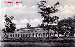
Ambala
| Ambala | |
|---|---|

| |
| Presidency: Bengal | |
| Coordinates: | 30.38°N 76.78°E |
| Altitude: | 264 m (866 ft) |
| Present Day Details | |
| Place Name: | Ambala |
| State/Province: | Haryana |
| Country: | India |
| Transport links | |
| FibiWiki Maps | |
|---|---|
| See our interactive map of this location showing places of interest during the British period | |
| [xxxxx Ambala] |
THIS PAGE IS WAITING FOR MORE DETAILED INFORMATION
Ambala was the headquarters of Ambala District in the Delhi Division of Punjab Province during the British period.The Ambala Cantonment was established in 1843 after the British abandoned its cantonment at Karnal, following the malaria epidemic of 1841-42.
It was a station on the North Western Railway
Spelling Variants
Modern spelling: Ambala
Variants: Umballa
FIBIS resources
- Photograph: Church, Amballa Cantonment from the FIBIS Gallery Album Railways / NWR/ H V O WATERS Collection
Churches
The cantonment church is called St Paul's and it has a large graveyard and war memorial. St Paul’s Church, ‘an edifice which has been much admired’ was designed by Captain George Atkinson of the Bengal Engineers, according to this Archives,org link. He was the author of Curry & rice' on forty plates : or, The ingredients of social life at 'our station' in India, published 1860, refer Society reading list, which may have been based on life in the cantonment at Umballa.
St Paul's Church was bombed in 1965 and is now in ruins.
Cemeteries
List and images of graves at Ambala Christian cemeterywww.gravestonephotos.com (Scroll down for list)
External Links
- Ambala City Imperial Gazetteer of India
- Ambala Wikipedia
- Ambala Cantonment Wikipedia
- Umballa in 1845 Missionary Register for 1845, page 527 Google Books
- Umballa is mentioned in Around the world on a bicycle Volume 2: From Teheran to Yokohama, page 299 by Thomas Stevens 1888 Archive.org
- Gazetteers Of Haryana, previously part of Bengal. Haryana Government website. Includes Ambala District 1883-84, 1892, 1923-24, the latter available as a searchable pdf.
- Paul’s Church Ambala by Ramesh Lalwani 4 December 2005 mangalorean.com
Historical books online
- "Topographical and Sanitary Report on Umballa and its vicinity, Upper India" by Dr Kendal, Surgeon, H. M.’s 7th Hussars, page 213 Army Medical Department: Statistical Sanitary and Medical Reports for the year 1859 (published 1861) Google Books