File:Junagadh State Railway 1938 Schematic Map.png

Size of this preview: 548 × 599 pixels. Other resolution: 748 × 818 pixels.
Original file (748 × 818 pixels, file size: 790 KB, MIME type: image/png)
Summary
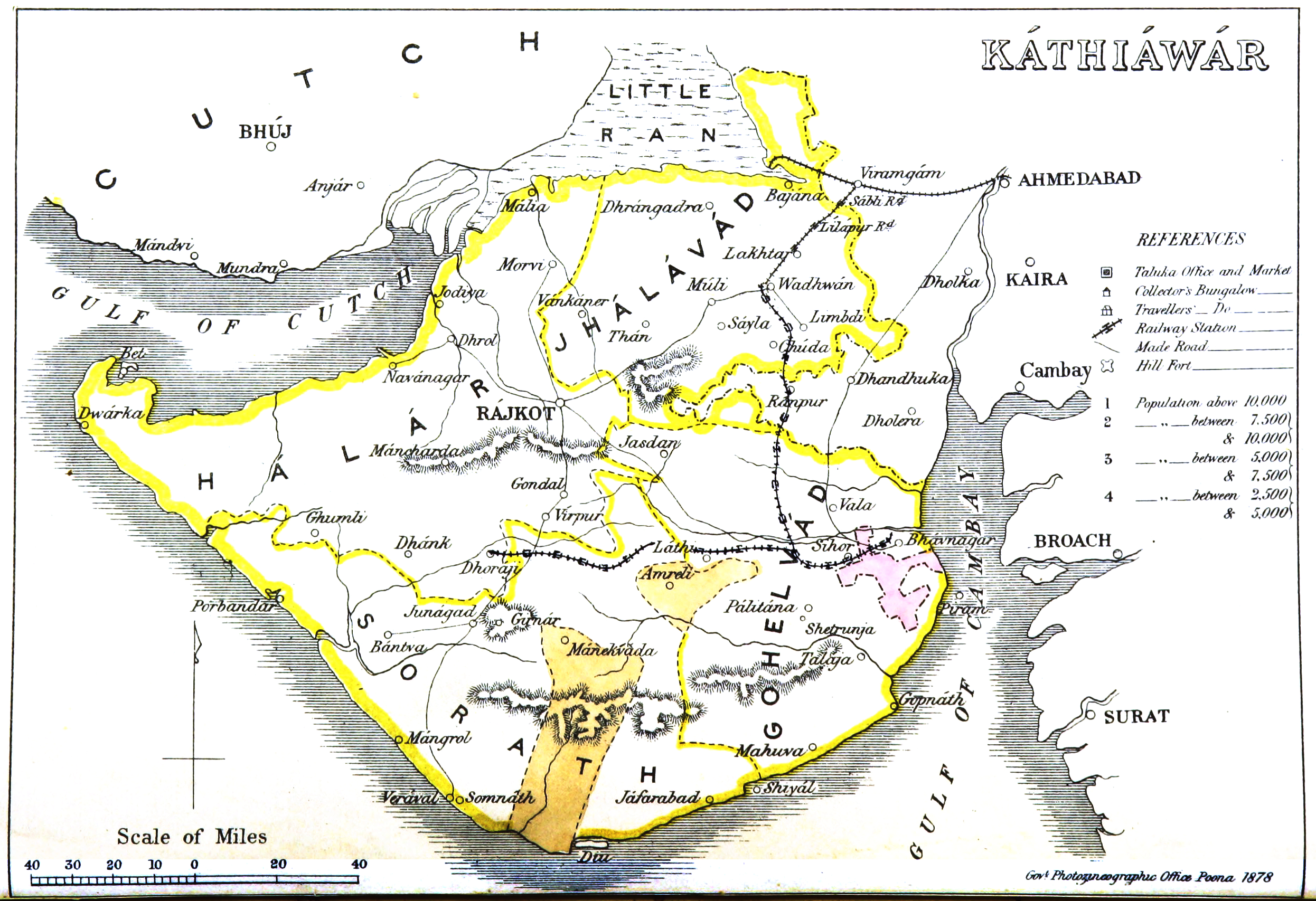
Junagadh State Railway 1938 Schematic Map
From ‘Gazetteer of the Bombay Presidency’ by James M Campbell, Government Photozincographic Office, Poona, 1878
Extracted from Click here, cut and marked up with route of railways
Licensing
|
|
This work is licensed under the Creative Commons Attribution 3.0 unported License. Specific Attribution: None specified Anyone may use this image for any purpose provided it is attributed as specified. |

File history
Click on a date/time to view the file as it appeared at that time.
| Date/Time | Thumbnail | Dimensions | User | Comment | |
|---|---|---|---|---|---|
| current | 09:37, 14 May 2020 | | 748 × 818 (790 KB) | PEA-2292 (talk | contribs) | '''Junagadh State Railway 1938 Schematic Map''' From ‘Gazetteer of the Bombay Presidency’ by James M Campbell, Government Photozincographic Office, Poona, 1878 Extracted from [https://upload.wikimedia.org/wikipedia/commons/4/4e/Kathiawar_map.jpg... |
You cannot overwrite this file.
File usage
The following page uses this file: