File:Kolar Gold Fields 1935 Map.jpg
Size of this preview: 800 × 358 pixels. Other resolution: 1,424 × 637 pixels.
Original file (1,424 × 637 pixels, file size: 394 KB, MIME type: image/jpeg)
Summary
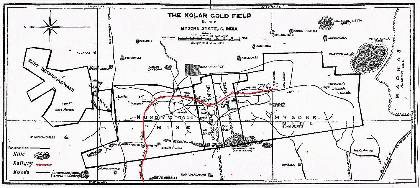
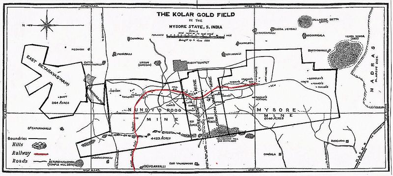
Kolar Gold Fields 1935 Map
Map supplied from Fibis member Steve Moore
Original source unknown
Licensing
|
|
This work is licensed under the Creative Commons Attribution 3.0 unported License. Specific Attribution: None specified Anyone may use this image for any purpose provided it is attributed as specified. |

File history
Click on a date/time to view the file as it appeared at that time.
| Date/Time | Thumbnail | Dimensions | User | Comment | |
|---|---|---|---|---|---|
| current | 11:19, 22 October 2020 | | 1,424 × 637 (394 KB) | PEA-2292 (talk | contribs) | '''Kolar Gold Fields 1935 Map''' Map supplied from Fibis member Steve Moore Original source unknown |
You cannot overwrite this file.
File usage
The following page uses this file: