Difference between revisions of "Fort St George"
Jump to navigation
Jump to search
Symorsebrown (talk | contribs) (Add info box) |
(Add external link to map) |
||
| Line 20: | Line 20: | ||
==See also== | ==See also== | ||
* [[Madras Cemeteries]] - details St Mary's Church cemetery | * [[Madras Cemeteries]] - details St Mary's Church cemetery | ||
| + | |||
| + | == External Links == | ||
| + | |||
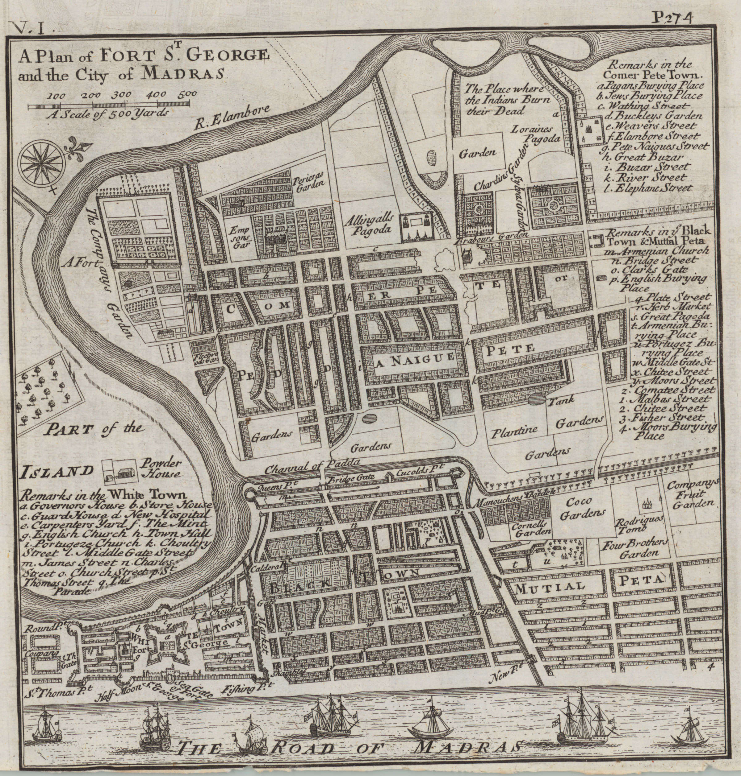
| + | [http://www.columbia.edu/itc/mealac/pritchett/00maplinks/mughal/mollmaps/madras1726/madras1726supermax.jpg A Plan of Fort St. George and the City of Madras, by Herman Moll, from 'Modern History: or, the Present State of all Nations', by Thomas Salmon. Published by Bettesworth & Hitch, London, 1726]. Source : Columbia University | ||
[[Category:Locations]] | [[Category:Locations]] | ||
[[Category:Forts]] | [[Category:Forts]] | ||
[[Category:Forts in Madras Presidency]] | [[Category:Forts in Madras Presidency]] | ||
Revision as of 09:55, 14 February 2011
| Fort St George | |
|---|---|

| |
| Presidency: Madras Presidency | |
| Coordinates: | 13.079722°N 80.286944°E |
| Altitude: | 0 m (0 ft) |
| Present Day Details | |
| Place Name: | Fort St George, Chennai |
| State/Province: | Tamil Nadu |
| Country: | India |
| Transport links | |
Fort St George was the name of the military garrison in Madras, and it was home to British Army units for many centuries. It is now the home of the state legislature for Tamil Nadu. The church in Fort St George is called St Mary’s and it claims to be the oldest Anglican church outside of Europe.
Contents
History
Photographs
The FIBIS database has some interior photographs of Fort St George.
See also
- Madras Cemeteries - details St Mary's Church cemetery
External Links
A Plan of Fort St. George and the City of Madras, by Herman Moll, from 'Modern History: or, the Present State of all Nations', by Thomas Salmon. Published by Bettesworth & Hitch, London, 1726. Source : Columbia University