Difference between revisions of "Rangoon"
Jump to navigation
Jump to search
(→Cemeteries) |
m (remove broken link) |
||
| Line 40: | Line 40: | ||
==External links== | ==External links== | ||
| − | |||
*[http://dsal.uchicago.edu/reference/gazetteer/pager.html?objectid=DS405.1.I34_V21_219.gif Rangoon City] Imperial Gazetteer<br> | *[http://dsal.uchicago.edu/reference/gazetteer/pager.html?objectid=DS405.1.I34_V21_219.gif Rangoon City] Imperial Gazetteer<br> | ||
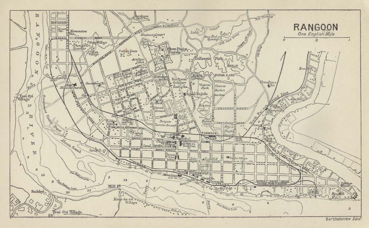
*[http://dsal.uchicago.edu/reference/gaz_atlas_1909/fullscreen.html?object=66 Map of Rangoon 1909] Imperial Gazetteer<br> | *[http://dsal.uchicago.edu/reference/gaz_atlas_1909/fullscreen.html?object=66 Map of Rangoon 1909] Imperial Gazetteer<br> | ||
Revision as of 07:31, 17 December 2013
| Rangoon | |
|---|---|

| |
| Presidency: Bengal Presidency | |
| Coordinates: | 16.868878°N 96.236255°E |
| Altitude: | 26m (85 ft) |
| Present Day Details | |
| Place Name: | Yangon |
| State/Province: | Yangon Division |
| Country: | Burma |
| Transport links | |
| FibiWiki Maps | |
|---|---|
| See our interactive map of this location showing places of interest during the British period | |
| [xxxxx Rangoon] |
Contents
THIS PAGE IS WAITING FOR MORE DETAILED INFORMATION
Rangoon, in what was formerly known as Lower Burma, was the capital of British Burma from 1885 and a separate district in Pegu Division during the British period. It was also the headquarters of Hanthawaddy District.
History
Rangoon came under British rule in the 1850s and was transformed into a busy commercial port. It became the capital of British Burma after Upper Burma was captured in the 3rd Burma War, making overland access from the rest of British India possible.
Military history
- Occupation of Rangoon 1824, part of the 1st Burma War
- Battle of Rangoon 1852, part of the 2nd Burma War
Spelling Variants
Modern name: Yangon
Variants: Rangoon
Maps
- Map of Rangoon 1912 from the Historical Maps of Asia Collection, University of Texas, Austin
Cemeteries
- The English Cantonment Cemetery, Rangoon (Scroll down to near the bottom of the page) from Steve Fogden’s “ Chindit Chasing, Operation Longcloth 1943”
- Rangoon War Cemetery
- Rangoon War Cemetery Roll of Honour roll-of-honour.org.uk
- Rangoon War Cemetery Scroll down for photographs and cemetery information from Steve Fogden’s “ Chindit Chasing, Operation Longcloth 1943”
- WW2Talk post CWGC Rangoon Memorial (Burma) 2010: Pics of all c27,000 names now available. A free offer.
- Taukkyan War Cemetery including the Rangoon Memorial
- Taukkyan War Cemetery and the Rangoon Memorialfrom above mentioned website of Steve Fogden
- Roll of Honour Taukkyan Memorial Roll-of-honour.org.uk
- Taukkyan War Cemetery cwgc.org
External links
- Rangoon City Imperial Gazetteer
- Map of Rangoon 1909 Imperial Gazetteer
- Holy Trinity Cathedral - Rangoon – 1886 flickr.com
- Photographs of colonial buildings in Yangon taken mid 2012 from the website of photographers Jacques Maudy and Jimi Casaccia with the article Burma: Visionary Photographers Train Cameras On Yangon’s Colonial Buildings Eurasia Review August 2, 2012
- A Fading Yangon Captured in Photos with a Slideshow September 13, 2012 Wall Street Journal Life and Style: Scene Asia