Difference between revisions of "Rangoon"
Jump to navigation
Jump to search
| Line 23: | Line 23: | ||
==Maps== | ==Maps== | ||
| − | *[http://www.lib.utexas.edu/maps/historical/rangoon_1912.jpg Map of Rangoon 1912] from the Historical Maps of Asia Collection, University of Texas, Austin | + | *[http://www.lib.utexas.edu/maps/historical/rangoon_1912.jpg Map of Rangoon 1912] from the Historical Maps of Asia Collection, University of Texas, Austin |
| + | |||
| + | ==External links== | ||
| + | *[http://www.flickr.com/photos/23268776@N03/2343526806/ Holy Trinity Cathedral - Rangoon – 1886] flickr.com | ||
[[Category:Locations]] | [[Category:Locations]] | ||
[[Category:Burma]] | [[Category:Burma]] | ||
[[Category:Cities, towns and villages in Bengal Presidency]] | [[Category:Cities, towns and villages in Bengal Presidency]] | ||
Revision as of 12:00, 10 February 2012
| Rangoon | |
|---|---|
| [[Image:|250px| ]] | |
| Presidency: Bengal Presidency | |
| Coordinates: | 16.868878°N 96.236255°E |
| Altitude: | |
| Present Day Details | |
| Place Name: | Yangon |
| State/Province: | Yangon Division |
| Country: | Burma |
| Transport links | |
Rangoon, in what was formerly known as Lower Burma, was the capital of British Burma from 1885.
History
Rangoon came under British rule in the 1850s and was transformed into a busy commercial port. It became the capital of British Burma after Upper Burma was captured in the 3rd Burma War, making overland access from the rest of British India possible.
- Occupation of Rangoon 1824, part of the 1st Burma War
- Battle of Rangoon 1852, part of the 2nd Burma War
Spelling Variants
Modern name: Yangon
Variants: Rangoon
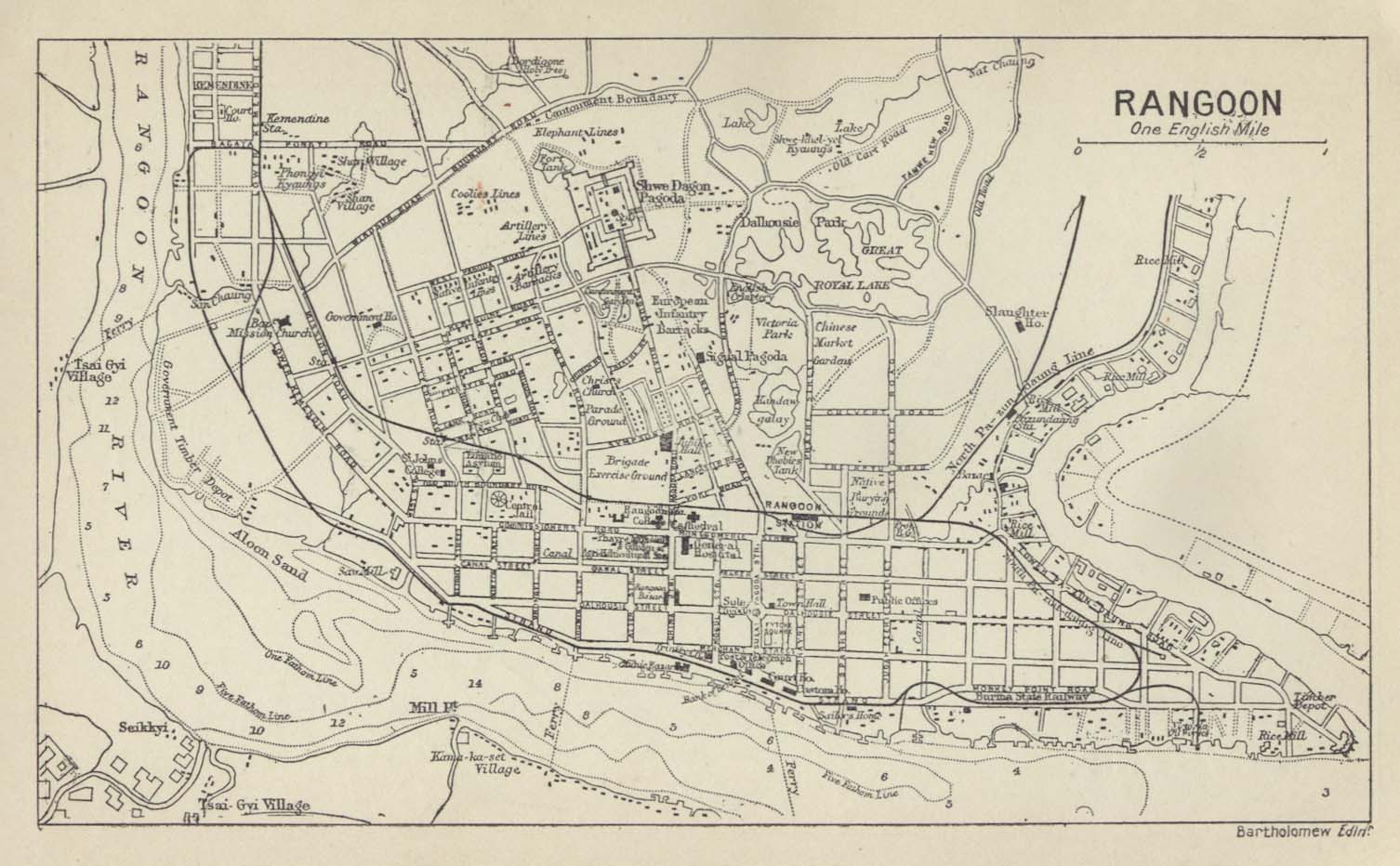
Maps
- Map of Rangoon 1912 from the Historical Maps of Asia Collection, University of Texas, Austin
External links
- Holy Trinity Cathedral - Rangoon – 1886 flickr.com