Benares
| Benares | |
|---|---|

| |
| Presidency: Bengal | |
| Coordinates: | 25.282009°N 82.956336°E |
| Altitude: | 80.71 m (265 ft) |
| Present Day Details | |
| Place Name: | Varanasi |
| State/Province: | Uttar Pradesh |
| Country: | India |
| Transport links | |
| Oudh and Rohilkhand Railway Bengal and North-Western Railway | |
| FibiWiki Maps | |
|---|---|
| See our interactive map of this location showing places of interest during the British period | |
| [xxxxx Benares] |
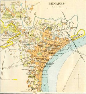
Benares was the headquarters of Benares District in the Benares Division of United Provinces during the British period. It had a cantonment with a British and Native garrison.

Spelling Variants
Modern name: Varanasi
Variants: Benares/Banaras/Kashi
History
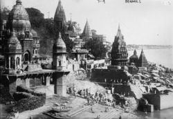
Varanasi, the Holy City of the Hindus, has an ancient history being one of the oldest continuously populated sites in the world. On the left bank of the Ganges, it is an important site of Hindu pilgrimage and is characterised by the burning ghats along the river. After a period of Muslim rule, Varanasi came under the patronage of the Marathas and subsequently was ceded to British control in 1775.
Military history
Mutiny at Benares in 1857 during the Indian Mutiny.
Churches and missions

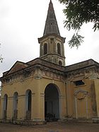
- St Mary's Church (Anglican)
- St Mary's RC Cathedral
- St Paul's Church
- Wesleyan Church
- (London) Mission Church
- Methodist Church
Missions
- Church Missionary Society (arrived 1817) - at Sigra
- London Missionary Society (arrived 1820)
- Wesleyan Missionary Society (arrived 1878)
- Baptist Mission (arrived 1816, left 1890)
- Zenana Bible and Medical Mission (formerly the Indian Female Normal School and Instruction Society, arrived 1868)
Transport
It was the first station on the Oudh and Rohilkhand Railway, after the latter's easternmost connection with the East Indian Railway at Moghal Sarai, as well as a terminus for the Bengal and North-Western Railway.
External links
Historical books online
- Benares City Imperial Gazetteer of India
- "Mofussil Stations: No V - Benares" page 335, The Asiatic Journal and Monthly Miscellany, Vol 10, New Series, Jan-April 1833. Google Books.
- The cantonment at Benares, page 298 Army Medical Department: Report for the Year 1862 Google Books
- Benares page 362 Report of the Commissioners Appointed to Inquire into the Sanitary State of the Army in India : with Abstract of Evidence, and of Reports Received from Indian Military Stations 1864 Archive.org
- A Hand-book of Benares by Rev Arthur Parker , London Missionary Society, 2nd and revised edition 1901 Archive.org
- "Missionary Societies", page 62
- "St Mary’s Church" page 74