| The Families In British India Society (FIBIS) is a self-help organisation devoted to members researching their British India family history and the background against which their ancestors led their lives in India under British rule. Let FIBIS help you break down those brick walls in your research |
Calcutta: Difference between revisions
| Line 89: | Line 89: | ||
*[http://members.lycos.co.uk/calcutta1940s/ Calcutta 1940's] | *[http://members.lycos.co.uk/calcutta1940s/ Calcutta 1940's] | ||
*[http://maps.google.co.uk/maps?f=q&source=s_q&hl=en&q=&vps=1&jsv=156c&sll=22.570526,88.351815&sspn=0.00959,0.019312&gl=uk&ie=UTF8&geocode=FWZuWAEdd1NEBQ&split=0 Kolkata, Google Maps] Map with many buildings marked | *[http://maps.google.co.uk/maps?f=q&source=s_q&hl=en&q=&vps=1&jsv=156c&sll=22.570526,88.351815&sspn=0.00959,0.019312&gl=uk&ie=UTF8&geocode=FWZuWAEdd1NEBQ&split=0 Kolkata, Google Maps] Map with many buildings marked | ||
*[http://www.archive.org/details/thackersguidetoc00firm Thacker's Guide to Calcutta(1906)] A free download is available. | *[http://www.archive.org/details/thackersguidetoc00firm Thacker's Guide to Calcutta(1906)] A free download is available from archive.org | ||
[[Category:Locations]] | [[Category:Locations]] | ||
[[Category:Cities, towns and villages in Bengal Presidency]] | [[Category:Cities, towns and villages in Bengal Presidency]] | ||
[[Category:Calcutta| ]] | [[Category:Calcutta| ]] | ||
Revision as of 05:48, 17 May 2009
| Calcutta | |
|---|---|

| |
| Presidency: Bengal | |
| Coordinates: | 22.572625°N, 88.363893°E |
| Altitude: | 9 m (30 ft) |
| Present Day Details | |
| Place Name: | Kolkata |
| State/Province: | West Bengal |
| Country: | India |
| Transport links | |
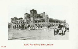
| East Indian Railway (Howrah) Bengal-Nagpur Railway Calcutta and South Eastern Railway (Sealdah) Eastern Bengal Railway (Sealdah) Calcutta Port Commissioners' Railway Arrah-Sasaram Light Railway Barasat-Basirhat Light Railway Futwah-Islampur Light Railway Howrah-Amta Light Railway Howrah-Sheakhalla Light Railway | |
Calcutta (present day Kolkata) is a large city in north-east India. Calcutta was the headquarters of the Government of the Bengal Presidency. It was also the capital of British India until Delhi became the capital on 12th December 1911. The city had a large European mercantile community.
History
Battle of Calcutta 1757
3rd Carnatic War
Spelling Variants
Modern name: Kolkata
Variants: Calcutta
Location
Calcutta is now known as Kolkata in modern day India and is situated at 22°33′N, 88°20′E in the Ganges Delta.
Places of interest
The Maidan
The site of Fort William, the Maidan was (and still is) the centre of Calcutta. It was bounded on the west side by the Hooghly River and the Strand Road, and on the east side by Chowringhi Road. Government House, the Governor's residence, was at the north end of the Maidan and Belvedere, the residence of the Lieutenent-Governor of Bengal, was near the southern end.
Eden Gardens
The Eden Gardens were started by Lord Aukland's sisters and are beautifully laid out. They were the main gathering place of Calcutta Society in the time of the British Raj. They are also the home of India's oldest cricket ground, the Calcutta Cricket Club, and have a lake which was the home of the Rowing Club. Beside the lake is a Burmese Pagoda brought from Prome and set up in 1856. There were many statues in the Gardens.
Churches and missions
Anglican
- St James Church - see FIBIS Journal 5, The Man Who Built St James Calcutta
- St John's Cathedral Church - conscreated 1787
- St Paul's Cathedral - completed in 1847
- St Peter's Church, Fort William - built 1828
- 'Old' Mission Church - see article in FIBIS Journal 7, includes a list of graves
- St Stephen's, Kidderpore
Roman Catholic
- RC Cathedral (Virgin Mary of the Rosary) - built 1797
- St Patrick's Chapel, Fort William - built 1857
- St Theresa - built 1893
- St Thomas' Church - begun in 1841, adjacent to the Convent of Our Lady of Loreto
Other denominations
- St Andrew's Church of Scotland - opened 1818
- Greek Church - established 1780
- Armenian Church
Missions
- Church Mission Society
- Free Church of Scotland - started in 1830
- London Missionary Society
- Oxford Mission - Church of England
- Society for the Propagation of the Gospel (Anglican)
Non-Christian places of worship
As well as the temples and mosques that served the general Indian populace, Calcutta also housed:
- Parsi temple
- Synagogue
- Chinese temple
Cemeteries
Education
Colleges
- Bengal School of Art
- Bishop's College, Circular Road - run by the Oxford Mission
- Calcutta Medical College - formerly Bengal Medical College, founded 1835
- Doveton College
- Presidency College
Schools
- La Martiniere School - established 1836
- St James' School - founded by Bishop Cotton in 1864
- St Lawrence High School
- St Thomas School, Kidderpore - founded 1789
- St. Xavier's Collegiate School - founded by the Jesuits in 1860
Economy and business
External Links
- History of Kolkata, Wikipedia.
- Calcutta Maps 1756,1839,1847,1883 Columbia University
- Calcutta Map 1842 David Rumsey Collection
- Calcutta 1940's
- Kolkata, Google Maps Map with many buildings marked
- Thacker's Guide to Calcutta(1906) A free download is available from archive.org