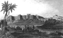
Hyderabad, Sind: Difference between revisions
Jump to navigation
Jump to search
m wikipedia links |
Symorsebrown (talk | contribs) Add coordinates and altitude |
||
| Line 2: | Line 2: | ||
|presidency=Bombay | |presidency=Bombay | ||
|image=Hyderabad_fort_1845.gif | |image=Hyderabad_fort_1845.gif | ||
|coordinates= | |coordinates= [http://maps.google.co.uk/maps?ll=25.390107,68.354214&z=13&t=h&hl=en 25.390107°N 68.354214°E] | ||
|altitude= | |altitude= 13 m (43 ft) | ||
|presentname= [http://en.wikipedia.org/wiki/Hyderabad,_Sindh Hyderabad] | |presentname= [http://en.wikipedia.org/wiki/Hyderabad,_Sindh Hyderabad] | ||
|stateprovince= [http://en.wikipedia.org/wiki/Sindh Sindh] | |stateprovince= [http://en.wikipedia.org/wiki/Sindh Sindh] | ||
Revision as of 15:05, 15 July 2010
| Hyderabad, Sind | |
|---|---|

| |
| Presidency: Bombay | |
| Coordinates: | 25.390107°N 68.354214°E |
| Altitude: | 13 m (43 ft) |
| Present Day Details | |
| Place Name: | Hyderabad |
| State/Province: | Sindh |
| Country: | Pakistan |
| Transport links | |
Hyderabad was the seat of government for the ruling families of Sind in the 18th and 19th centuries. It was also the first capital of Sind under the British, until it was shifted to Karachi in the 1840s.
History
Battle of Hyderabad 1843
Forts
- Pucca Qila