Dibrugarh
Jump to navigation
Jump to search
| Dibrugarh | |
|---|---|

| |
| Presidency: Bengal | |
| Coordinates: | 27.48°N 95.00°E |
| Altitude: | 108 m (354 ft) |
| Present Day Details | |
| Place Name: | Dibrugarh |
| State/Province: | Assam |
| Country: | India |
| Transport links | |
| FibiWiki Maps | |
|---|---|
| See our interactive map of this location showing places of interest during the British period | |
| [xxxxx Dibrugarh] |
Dibrugarh was the headquarters of Lakhimpur District of Assam Province during the British period. It was the headquarters of the Assam Valley Light Horse.
"Dibrugarh Is one of the most desirable stations in the plains of Assam"[1]
Railways
- Dibru-Sadiya Railway
- It became the location of the Assam Bengal Railway Workshops from 1935
Related articles
Churches
- St Paul’s Church, originally Church of England
- St John’s Church. Believed to be Church of Scotland. There was a St John’s Church in Dibrugarh and there was a Church of Scotland church in Dibrugarh [2] and it is likely they were the same church
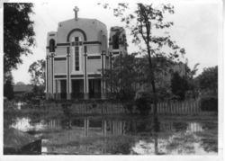
- Roman Catholic: The Dibrugarh Mission was opened in 1909 by the German Salvatorians. The fathers had to leave at the outbreak of the First World War. The parish was restarted in 1931, and the present site was obtained in 1936.
External Links
- Sacred Heart of Jesus Dibrugarh
- British cemetery lies abandoned in Dibrugarh November 03, 2010 The Assam Tribune
- British graveyard to get tourism push July 1, 2011 The Times of India Guwahati
Historical books online
- Dibrugarh Town Imperial Gazetteer of India, v. 11, p. 342.
- Assam District Gazetteers: Lakhimpur Vol. 8, by B C Allen. 1905, Archive.org
- Lakhimpur Supplement 1916 Archive.org, Public Library of India Collection.
References
- ↑ Imperial Gazetteer of India
- ↑ Family Tree of Oswald Wrangham Scroll down to 1.2.1.1.4.1.6.6.8.4.1.1. John Robin Wrangham